|
[ Back ] [ Home ] [ Up ] [ Next ]
|
Click any picture to
enlarge; then close out of that window to return here. |

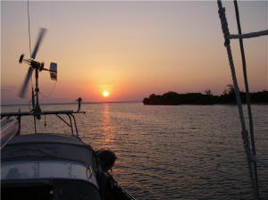
Waiting for weather window in
Houston/Kemah |
|
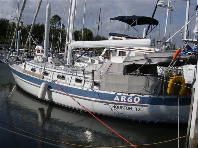
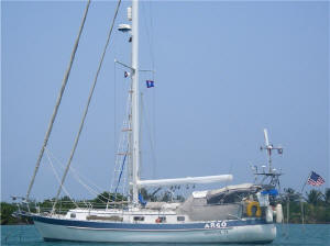
HOUSTON:
|
 |
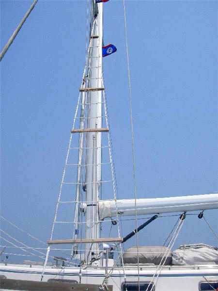
Rat line extending from deck to
1st spreader, secured to shrouds
|
Waiting on Deborah's dental work
and then a suitable weather window gave us plenty of time to get things just
so on ARGO. We had a rat line made for our port side - a rat line is a
ladder made of rope with wood rungs that is lashed to our shrouds, the
ladder extending from deck to the first spreader - which we (Steve) will
climb to aid our visibility when maneuvering in shallow waters and between
reefs, of which there will be plenty where we are headed. We also
acquired headsets that operate hands-free duplex mode so we can communicate
more clearly while not only up in the rat lines, but while setting or
bringing up the anchor. Anchor duty for most cruising couples is
typically done with
hand signs (or rude gestures) and in loud voices (or cursing shouts), entertaining other
cruisers
in the anchorage. So now we can at least give the appearance of
being more civilized! Actually, the headsets have made it a much more
pleasant experience for both of us.
We provisioned the boat well,
stocking the freezer full. We had been told that Belize is expensive,
so don't plan on buying much there. We'll wait until Guatemala.
As beer, wine and liquor can be expensive at times, we loaded up on 11 cases
of beer, and wine and various other spirits. As we didn't want lots of
bottles of wine unsecured on the boat for the crossing, and since there are
now decent boxed wines on the market, we acquired boxed wines, took the
bladders out of the boxes and stowed the bladders behind the settee - this
worked perfectly as this is an odd shaped area and the bladders conform to
it's shape and size
- in one small locker we have 7 bladders stowed - the equivalent of 28
bottles! In all, we left with the equivalent of 100 bottles of wine on
board.
|
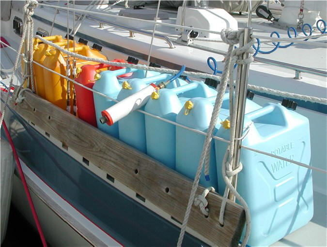
 |
Jerricans,
always a sign of a true cruiser - water, gasoline (for
outboard), diesel
|
We now know more than we did when we
left the first time: What we used or needed vs. what we thought
we would use or need. We left behind the WonderWash (salad-spinner
type washing machine), pressure cooker (we bought too big and stowed it
where it was too hard to get to), porcelain dishes (only broke one but still
had to be careful), a lot less clothing (don't need much), and Deborah
sacrificed her much-loved live plants - during passage they rode on the
gimballed stove or in the galley sink (always in the way) or at anchor they
needed their light so sat under the dodger (always in the way). No-maintenance silk
plants were substituted. We added an iPod (which meant taking
off a couple hundred CDs and freeing up space), took a 2nd laptop and more computer stuff, more
exercise stuff for Deborah, the heavy-duty electric massager (sore backs), and more spare
parts and tools - "you can never have enough tools" the guys say.
We also had Quantum (Jocelyn Nash in their San Francisco loft) make us an
asymmetrical spinnaker and friend Jose gave us training on it. This
huge sail, which has more square footage than all the rest of our sails
combined (1,400 sq. ft) will only be used in light air. Sure wish we
had had it coming across the Gulf of Mexico last year!
|
|
GULF of MEXICO
CROSSING
MARCH 20 - MARCH 27, 2006:
After waiting 3 weeks on ARGO in the marina for a weather window in Houston,
it was time to leave on the tail end of a cold front, with a second cold front
to follow a few days later. The reason: Our course to Isla Mujeres,
Mexico (near Cancun) was on a southeast course, and north/northeast winds
would give us a nice ride down, beam or broad reaching. We let the
cold front just pass (as it tends to bring squally weather on the leading
edge) and headed out with blue skies and cool northerly winds.
We had met s/v Tantalus (Brits Noel & Nicola), who were also heading to
Mexico, at our marina the week before and discussed weather and sailing
strategies down the Yucatan Channel with them. They left the same day
and we remained in radio contact the first couple of days. As usual,
leaving Galveston's jetties and dodging our way through the various safety
fairways (it's like 5 spokes on a wheel coming together), safety anchorage,
rigs/platforms and
big ship traffic was somewhat stressful. Twenty-four hours later we were pretty
much clear of the fairways and just had to keep an eye out for any traffic,
coming from any direction. To give you an idea how busy it was,
Deborah was busy watching the radar and everything made sense. Once we
were clear of all the congestion, the radar wasn't making sense anymore.
Weird. Soon enough Steve realized that somehow the radar had gotten
reset to a "north-up" orientation, instead of the "heads-up" orientation we
always use. How in the world we didn't get run over we're not sure.
Another little lesson learned.
On the 2nd day out, after downloading
weather, getting weather updates via email from Houston friend Jose, getting a message relayed to us from Tantalus, and getting a
weather report from a nearby ship, we confirmed that a big bad-ass cold
front was heading our way (much stronger than originally predicted): 25 knot
winds (which we know really means 30) and 12 - 15 ft. seas! The winds
we can handle, but the seas had us concerned. Getting cross to a big
wave can be bad news. At that point, Deborah had a brief meltdown (5
minutes of crying) as she vividly recalled her 1986 winter passage from
Houston to Cozumel in which she got into a really bad storm with 15 - 18 ft. seas
---
a mini Perfect Storm. At the time she was too young and naive to
realize how serious the situation was. Anyway, back to real-time
reality. After analyzing our weather data further, we decided we might be
able to avoid the worst of the conditions if we headed due east, where seas
were predicted to be only 10 - 12 ft. And so for a day we headed due east as
best as possible while still sailing. (We had another very good reason
to stall our arrival at the Yucatan Channel: A very strong current
runs north through the Yucatan Channel. When northerly winds, i.e. a
cold front, blows through, the south-bound winds meet the north-bound
current head on, creating huge, abrupt waves and dangerous sea conditions,
known as "square waves". We wanted to avoid that, and thus another day
out to allow seas to calm down was just fine with us.) We readied the boat assuming
worst case: Made sure EVERYTHING was securely stowed away, floorboards
and lockers locked, packed a second but supplemental ditch bag with computer
backup hard drive and other semi-important things. I remember my Girl
Scout days - Always Be Prepared.
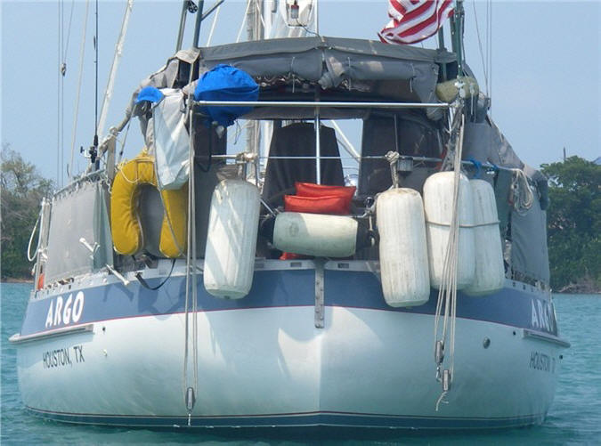
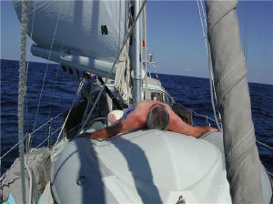
 |
|
Her nice, buoyant ass delivers a
comfortable ride
|
After the pleasant lull before the storm
(took showers, nice hearty meal, got some sleep, shortened sail), winds started to pipe up. A day
later increasing following seas ensued. Winds steadied at 30 knots, gusting to 39, and seas
reached 12 ft. with an occasional 12++ footer; however, the wave period (time
between each wave crest) was 7 seconds, so what we experienced were really
big sea swells, but not the wall-of-water breaking waves of Perfect Storm
fame. Although one could still get into trouble with these big swells,
we adjusted our speed by adjusting our sails - broad reaching under reefed
staysail alone - to give us steerage and just let the waves slowly go by
under us.
Our auto
pilot handled it fine and we didn't loose any wine bottles to breakage.
(Incidentally, we turned our auto pilot on when we left the Houston marina
and didn't turn it off until we entered Isla Mujeres.) Also, our
Valiant has what is called a North Sea tumble-home stern (sometimes mistaken
for a canoe stern) which has a lot of reserved buoyancy and thus handles a following
or quartering sea in great comfort.
One little oversight lead to a stack of
laundry: Before leaving, Deborah checked all the hatches and ports to make
sure everything was closed and locked and they were. Only one little
problem. The forward most hatch (the one that takes the brunt of the
waves) which has a security cable (we use in high risk areas so the hatch can
only be opened a few inches thus keeping someone from climbing in at night)
had gotten caught under the seal, thus leaving a small place for water to
come through. Discovered a day later, the v-berth quilt, sheets,
mattress pad, and some pillows were partially wet with salt water. Considering
all the blue water we were taking over the bow, we were surprised there
wasn't more water below. Nothing that a few loads of laundry can't
fix, but another lesson learned.
|
 |
Taking a
well-deserved nap on the dinghy (carried up-side-down on
foredeck)
|
Back on course for Isla Mujeres, we
had favorable winds to get us to the Campeche Bank off the Yucatan
Peninsula. Within striking distance of Isla Mujeres, it was a gamble
if we could get in (through the reefs) before dark, so decided to take a lay
day of sorts, and literally drifted with the 2 knot current toward our
destination. A cool and beautiful day and no traffic, we lazed around,
drank Bloody Mary's, listened to Sunday morning jazz (XM radio), read, cleaned up the boat and wound down, ready for our last night out.
Another reason to delay our arrival until Monday was that we then would not
have to pay overtime fees to clear in to customs and immigration - always
worth considering as overtime fees can sometimes be hefty. During the
night, a large boat approached us from miles away showing constant red and
green lights (that means its heading straight for us), as we kept changing
course (now under high rpm motor power) it kept following us. We
finally slowed down and let it "sniff" us out, and eventually it left us
without any radio contact - or warning shots fired. We guess it was the Mexican Navy taking a
peek. Anyway, always disconcerting when it happens at night.
With the exception of a couple of
days, we had a decent passage and only had to run the engine for 38 hours.
The air was cool and dry, and with the gentle rocking of the sea swells
produced excellent sleeping conditions, and a quarter moon and stars aided
the night watchman while enjoying our XM radio. One night Deborah was on
watch and suddenly saw a big ship directly off the bow, looming large and close.
Where did that come from so suddenly, she wondered. She called Steve to come up
"now" to confer on a course. Steve popped up straight away and
realized it was the quarter moon rising on the horizon. Boy, it sure
looked like a ship. It's amazing all the things you start to "see"
when on night watch.
We arrived in Isla Mujeres just after sunrise via the
north entrance (enter through/over these reefs only in calm conditions)
after 7 days - our longest passage to date. What this
also means is that we just had 7 ZD days - this, of course, means "zero
dollar" days and gives a boost to our cruising budget.
Incidentally, knowing that the Gulf
Stream runs fast and strong north through the Yucatan Channel, then curves
east along the north coast of Cuba towards Florida, our Plan B, if we were
not able to make Mexico due to weather conditions or fuel shortage, was to
ride the Gulf Stream to Florida. On board we carried a full set of
charts for Florida and surrounding area, and the Gulf coast, too, just in
case. We carry 135 gallons of diesel in tanks and another 15 gallons
on deck in jerricans - with this we can motor constantly for about 7 days
straight. This passage was 745 n. miles, compared to our return trip last
May of 687 n. miles, the difference being a day of easting this time to avoid
the higher seas.
|
|
How do we get our
WEATHER
when underway? We normally get all our weather via the SSB radio.
We download various text
messages + graphic grib files via HAM Winlink catalogs/emails;
download NOAA wind and wave 24/48/72 hours graphic weather faxes at
specified times using JVComm32 software; check into the area's
net, in this case it was the NW Caribbean Net (6209 USB,
1400 UTC). On this crossing, Houston friend Jose was checking
weather and giving us routing advice and recommendations by email; and we
also got weather forecasts from a commercial ship. |
|
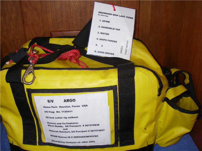
So what's in a
DITCH BAG?
Our
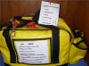 commercial
purpose-made waterproof ditch bag includes a disposable camera (if your
boat is sinking take pictures 'cuz it'll help you sell your book later),
emergency equipment (e.g., GPS, flares, flashlights, signaling mirror,
airhorn, whistle, solar blanket), first aid / hygiene / sun protection
(e.g., antibiotics, pain and sea sickness meds, bandaids/wraps, sunscreen, hats,
sunglasses, toothbrush/soap), survival (e.g., handheld watermaker,
ziplock bags (for water, personal waste), food items, fishing leader /
line / hooks / gloves / cutting board, reading glasses, paper/pens, etc.
Yep, all the above, and more, is in that yellow bag. There are
also very basic items in the life raft. On the way out, we need to
grab the EPIRB and handheld VHF. If there's time, then more water, $,
first aid kit, boat papers, external / backup hard drives (yeh), binoculars,
extra signal / flare canister, shoes . . . commercial
purpose-made waterproof ditch bag includes a disposable camera (if your
boat is sinking take pictures 'cuz it'll help you sell your book later),
emergency equipment (e.g., GPS, flares, flashlights, signaling mirror,
airhorn, whistle, solar blanket), first aid / hygiene / sun protection
(e.g., antibiotics, pain and sea sickness meds, bandaids/wraps, sunscreen, hats,
sunglasses, toothbrush/soap), survival (e.g., handheld watermaker,
ziplock bags (for water, personal waste), food items, fishing leader /
line / hooks / gloves / cutting board, reading glasses, paper/pens, etc.
Yep, all the above, and more, is in that yellow bag. There are
also very basic items in the life raft. On the way out, we need to
grab the EPIRB and handheld VHF. If there's time, then more water, $,
first aid kit, boat papers, external / backup hard drives (yeh), binoculars,
extra signal / flare canister, shoes . . . |
|
Do we get
SEA SICK?
Steve does not. Deborah hasn't been sick in over 20 years, but
sometimes may feel a little bit tentative. What I, and other
cruisers swear by, is the generic drug Cinnarizin, sometimes known as
Stugeron (Europe). It is not available in the U.S., but is
available pretty much every place else we've been over the counter,
and is cheap. It
has no side effects that I've experienced or heard of. Ginger -
ginger ale, ginger snaps, anything with ginger - is also effective for
milder cases. |
|
For
SAFETY at SEA during passages
we have a few rules we strictly abide by. Safety harnesses are
always worn at night and in rough weather, and are always tethered to
the boat when in the cockpit. If someone has to go forward at
night or in rough weather, the other person must be topside. We
have jack lines (flat webbed line that you clip your harness tether onto
that then allows you to go forward, your clip sliding on the line with
you) that run the full length of the boat on both sides. We always
log our position (latitude & longitude) every 2 hours (or more
frequently in heavy weather or thunderstorms) along with our heading,
course and speed over ground, set/drift, wind speed/direction
and anything else of interest. We typically use navigation
software on the computer, but we always have hard copy charts and will
plot our position and course on them as appropriate. We always run
radar at night, but if in a very low traffic area may put on standby to
conserve power. We attempt
daily to download weather, and check into a cruisers net on the SSB radio to give our position,
and usually have another contact/boat to check in with on the SSB. We
curtail our adult beverage consumption to a drink at happy hour, maybe a
beer at lunch in calm conditions, nothing in bad weather. And yes,
someone is always on watch. (We hear stories of cruisers going down
below to sleep and leaving the unattended boat sailing through the night!
Single-handers typically sleep in the cockpit and have a timer or alarm that
goes off every 15 minutes or so. We had a near head-on collision one
night (years ago) - neither VHF radio nor air horn woke the boat up -
suppose he could have been dead.) |
|
What's our
WATCH SCHEDULE when
making a passage? This is a common question. Well, we don't have one.
Yes, while someone is always on watch, it's loose during the daytime and we
take turns napping or working below. At night, it's usually not a
problem as one of us is usually wide awake, the other sleeps. The
sleeping person sleeps until wakes up, or the watch person gets tired.
In rough weather or heavy traffic, both of us may be on watch together.
But if there's ever a question about traffic or impending bad weather or
sails need adjusting it's understood you wake the other person, and we do. By the way, the off-watch person sleeps in the aft cabin,
which has a "pizza window" so it's easy to hear/ see/ communicate on what's
happening topside. |
|
|
WESTERN CARIBBEAN /
CENTRAL AMERICA: Our new cruising ground

|
|
MEXICO
|
 |
First order of
business: Margarita y cerveza muy frio, ceviche, tacos on the beach .
. . ahhhhh
|
MARCH 27 - APRIL 9, 2006:
On our way back to
Houston last year, we stopped here for a couple of days so we were already
familiar with the island and clearing-in procedures. However, we are
now allowed to clear ourselves in without having to use an agent (saves us
US$150), but hurricane Wilma wiped out the Bank or something so we had to
take the fast and inexpensive ferry to downtown Cancun to pay the Port
Captain fees. Two days work and we're now legal in Mexico and ready to
explore.
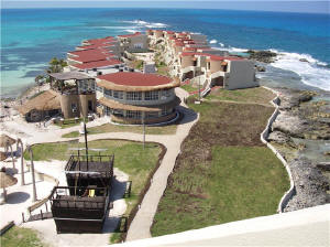 |
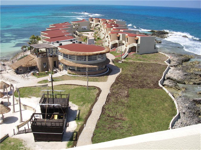
North point of
island resort
|
Waiting for the return ferry, a
respectable local approached us about visiting a resort time-share deal on
Isla Mujeres. Knowing how those things usually go (we had a bait 'n
switch on the promised gift in St. Maarten) we showed no interest until he sweetened
the deal, we couldn't refuse. What we do have is time, so what the
heck, could be an adventure. At the least we can tour a nice resort that we
wouldn't have done otherwise. The next day we walk to the resort -
it's on it's own little island surrounded by beautiful turquoise waters and
manicured beaches - connected to Isla Mujeres by a wee bridge. We had
a pleasant, low-pressure tour from a nice Canadian lady and others who
seemed more interested in our cruising lifestyle than in selling us
something that we couldn't use now. In the end, we left with:
Full lunch with beer and margaritas, golf cart rental for 24 hours, our
previous day ferry trip refunded in cash, a large bottle of tequila and of Kahlua, and a Mexican blanket. So, after 7 ZD days, and now this, the
budget is really looking good!!!
Isla Mujeres is an
island situated across from Cancun. It's hard to tell what is
hurricane Wilma damage and what is in a normal state of progress here, it's
not obvious. Although we did not go there, we hear that Cancun's hotel
zone was really hit hard, wiping out whole plazas and structurally damaging
hotel towers. We took our free golf cart and explored the entire
island - 5 x 1/2 miles - ending up at the taco stand under the little
stadium. We had eaten there last year - tables outside, great menu, a
tasty taco bar with all the right fixin's, cheap, and now they even serve
beer!
|
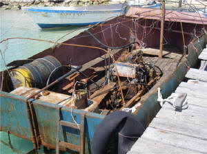 |
Not your typical
tourist, this "boat" had just arrived from Cuba; note the wiring.
|
Cancun is supposedly the 2nd hottest
vacation spot after Paris, sure spring breakers help those stats.
Isla Mujeres is a day trip for the Cancun vacationer, or the final
destination for others. Either way, the island is full of pasty white
people with splotches of bright red. Golf carts are the preferred
method of transportation, with scooters, rental cars and taxis next.
The islanders are quite tolerant, and protective, of their revenue source,
as they always give the right of way on the road to the tourist. Wise.
Isla Mujeres is also a crossroads for cruisers going to/from Texas and
Florida, and places south.
What's a typical day(s) like (after
spending 2 days clearing in, and another day touring and getting our
freebies)? Steve always starts the day with 1) the local net for
the anchorage, if
there is one, 2) the NW Carib net or whatever is appropriate for our area,
3) download over SSB our e-mail including text message and grib file
weather, and 4) download weather faxes if deemed necessary; Deborah played
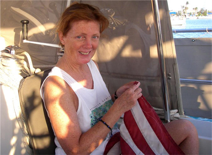
Betsy Ross mending our USA and Texas flags (flogged mercilessly in the high winds);
after we realized our ATM cards (our only source of $) were expiring in 3
days we had to figure out where the replacement cards were, have then sent
by FedEx and then activate them (activation alone took a couple of hours
trying to find a phone that would work on the designated 1-800 number); get
cash / local currency; again; take laundry in; pick laundry up; find
internet to check hotmail, attempt to cancel Verizon cell phone that should
work here but doesn't; call Verizon by phone to cancel and
|
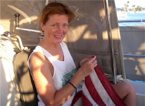 |
Doing the Betsy
Ross thing
|
haggle with person
who wants to assess cancellation fees contrary to our agreement; buy more
wine ($5 for decent stuff); buy 5 more cases of beer (Sol local beer, good;
yes we still have beer on board from Houston); provision with fresh produce
mostly; jerrican diesel from fuel dock to boat (15 gallons at a
time, 3 trips); send
mail back with a cruiser flying back to USA; copy waypoints from s/v
Tantalus from their entire cruising guide; get a list of waypoints from
another cruiser; pull up anchor and recalibrate our B&G instrument's compass
by doing a couple of 360's (required consulting the instruction book first -
who do you think did this - Steve or Deb?); read, plan. plot and input
waypoints for the route to our next destination, Chinchorro Bank (an atoll);
fix leak in head - Steve squeezed silicone around piston cartridge, quick 'n
easy fix, let's see if that
works; rig part for broken
shackle used for guy lines for whisker pole; figure out strange sound coming
from watermaker - this was actually an easy fix without having to tear the
entire system apart (but didn't last); change some annoying settings on the radar, The Cap'n
nav software, and VHF (some of this required reading the instruction
manuals- ooooh - who do you think did this - Steve or Deb?); clear out of
Mexico.
And of course there was a cruiser pot luck dinner, where we met many new
cruisers (this is a new cruising area for us) and several boats from Texas.
Unless they're headed back to the States, we'll probably see most of them on
the Rio Dulce river, Guatemala, in a few months for hurricane season.
After a week in Isla,
we take off for a 2-night passage south towards Chinchorro Bank, an atoll
lying 18 miles offshore Mexico. Chinchorro Bank, and 3 atolls offshore
Belize, are the only true atolls located in the northern hemisphere and are
said to resemble those of the South Pacific. Our passage will
eventually take us across the Yucatan Channel and around Cozumel, where the
north-flowing current can attain speeds up to 5 knots! For a sailboat,
even with a motor, this can be almost impossible to make headway. Our
plan was to sail close to shore (but not too close at night due to reefs)
and catch the countercurrent flowing south. The winds were good, but
unfortunately backed to the north soon enough, forcing us to fall off the
shelf and within minutes we were caught up in the strong current north.
We went to plan B and decided to sail east, cutting just north of Cozumel's
far-reaching bank. We saw just over 4 knots of current against us for
a while, but were able to make a few knots headway, albeit in lumpy,
confused seas as the current funnels around Cozumel. Eventually, we're
out of the mainstream and conditions settle down. A perfect
lemon-wedge moon presented itself during the night.
|
 |
Atoll Chinchorro
Bank, Mexico: Inside the reef, looking at Cayo Norte
|
We arrive at
Chinchorro Bank after sunrise navigating between the 2 reefs, where the only
boat is s/v Tantalus, our Brit friends from Houston + 3 crew. The
atoll is 26 x 9 miles big, with 4 small cays located inside. The only
inhabitants, the Mexican Navy with a small base onshore Cayo Norte, are
diving for conch as we anchor in 12 ft. of clear turquoise water. Over
lunch and blender drinks, Tantalus tells us to expect the Navy's visit at
sunset, as for them the Navy boys (one dressed in a uniform) pulled up to their
boat and all 5 came aboard with 3 automatic weapons. They were very
friendly and polite, filled out the obligatory paperwork shuffle, then
presented them with a Customer Satisfaction Survey - kind of hard not to
rate their service "excellent" when they're standing over you with machine
guns!!! Our experience was similar at sunset sans the machine guns -
maybe only 2 people on board made the difference. Tantalus left that
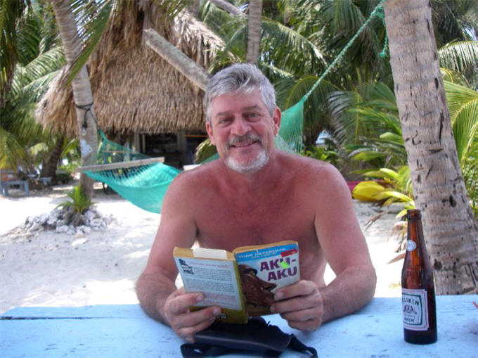
evening and we stayed 3 nights alone waiting for the winds to simmer down a
little before making another night passage to Belize. Deborah worked
on her required 40 hours of CPA continuing professional education due soon
and more flag mending; Steve read and drank beer and did guy boat stuff.
We depart Chinchorro
Bank, Mexico mid afternoon for an overnight sail to Belize. Winds
lighten up at night and the iron genoa (engine) is required part time.
Midnight brings threatening weather and backing winds to the north causing
confused seas. Our timing again, is spot on arriving at the reef
after sunrise. At this point since leaving Houston, we've done more
sailing at night than during daylight, but from here on out it'll be day
hops down to the Rio Dulce.
|
|
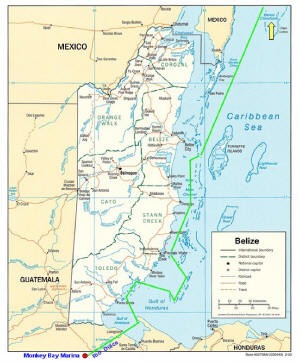
BELIZE '06
(click map to enlarge, see our route and Monkey Bay
Marina at bottom)
|
BELIZE |
|
AREA: |
About the size of Massachusetts |
|
POPULATION: |
287,000 |
|
LANGUAGE: |
English (official), Garifuna
(Indian), Spanish, Creole |
|
MONEY: |
Belize dollar US$1 =
BZ$2 |
|
INDUSTRIES: |
Agriculture ("yellow gold" bananas),
fishing, tourism |
BRIEF HISTORY:
In the 16th century Spain claimed possession of Belize but found no reason
to develop it. The area became a hangout for pirates waiting for
gold-laden Spanish galleons to pass by or shipwreck on the reefs, later switching to exporting
Belize's mahogany to Europe. In the late 1700's, British forces
delivered Belize from Spanish rule, thus it's English language and customs.
It later became known as British Honduras and in 1981 became the independent
nation of Belize. However, Guatemala has never fully recognized this
fact and as recently as 1994 renounced it's claim on Belize. Things
settled down in 2001 only to flare up again over border disputes. It
is not unusual now to see a map of Guatemala that includes the Belizean land as part of
Guatemala or the notation "Border Not Definite", or a travel guide
that fails to list Belize as one of Guatemala's bordering neighbors !
Belize 's official language is English,
although due to the ethnic mix other languages are spoken. The largest
part of the population is Creole, descendants of African slaves and
Europeans (British pirates), speaking their own English dialect. A
third of the population are mestizos, a mixture of Indian and European.
About a tenth of the population is Garifuna Indians, a mixture of Carib
Indian-African descent having been brought in by the British around the
1800's from St. Vincent (E. Caribbean). About 20 percent are Maya and
Ketchi Indians from Mexico, speaking Spanish or their own language. In
the 1950's Mennonite farmers, a German-speaking religious sect originating
from Switzerland, settled in Belize and are the primary producers of fruits,
vegetables and dairy products. Within the last couple of years,
sizable oil reserves have been found on their property and storage tanks now
constructed near Placencia. A few shipments have recently gone south
to Panama for refinement and distribution. |
APRIL 10, 2006 - MAY 8, 2006 :
|
 |
Robinson Point
Cay, our first stop in Belize
|
Belize is bordered by
a large barrier reef, 2nd in size to Australia's great barrier reef, which
lies in excess of 10 miles off the mainland coast. Inside the reef,
hundreds of small cays are scattered all over, some populated, and depths
are generally quite shallow. ARGO draws 6'4", more than the average
cruising sailboat, which will prohibit us from certain areas. North of
Belize City, which lies halfway down Belize's coast and is termed by many as
the arm pit of Central America, it is very shallow and we prefer not to
tempt fate just yet as there are plenty of other areas for us to explore.
Names like Porto-Stuck help reinforce that notion. We enter through
the reef just south of Belize City via their marked zig-zagging main ship
channel and find refuge from the north winds at Robinson Point Cay.
Next day, south to Blue Ground Range, with is numerous cays and cuts, of
which only one is deep enough to enter. After much back-and-forth
(both with the boat and verbally), trying to visually confirm and make sense
of the waypoints we had, we ventured through the narrow 8 ft. deep cut into
the deep, lovely lagoon, surrounded by several cays. As we went in, we
marked our own waypoints and used them in reverse the next day to leave.
|
What are WAYPOINTS? A waypoint is a geographical position
on the globe defined with exact latitude and longitude coordinates.
The GPS (Global Positioning Satellite) has made the use of waypoints for
navigating commonplace, and cruisers share theirs routinely.
However, we are ultimately responsible for our own navigation and
therefore use data from others to help supplement what we have and to
form our own opinions and routes. Waypoints are punched into the
GPS' memory and recalled as needed, or saved to memory on the fly.
A string of waypoints creates a "route". For example, we have
created a route going into an anchorage; we have then used the route in
reverse order to leave an anchorage in the dark for a night passage.
We would only do this where waters are deep, not in reef strewn areas.
|
 |
|
At anchor in Placencia, Belize
|
We arrived in
Placencia, Belize (a port of entry) on Wednesday before Easter. Fellow
Texan Hal, s/v Griffin, who we met last year in Isla Mujeres, have kept in
touch with since and did daily SSB check-ins with during our passage, is
here. We've brought him a bunch of boat projects (stuff he requested
from the States). He advises us not to check into customs/immigration
until after Easter. As is typical in the Caribbean, the locals take 4+
days off for Easter. To clear in we have to take ARGO up a river and
anchor off the big ship port wharf, dinghy ashore, and taxi around to the 3
agencies. Fortunately everybody was in a good mood coming off the long
holiday weekend (we fibbed saying we had just arrived in Belize the day
before): We weren't assessed some expected fees; only got a lecture
when we told the agricultural guy we had bought fresh produce in town the
day before (he waived his right to inspect our boat saying he'd have to
throw all the produce out as he wouldn't know where it had come from (our
taxi guy had forgotten to warn us before hand); and were told by customs we
did not have to bring ARGO back when we clear out (contrary to what
other cruisers have been told - we got the guy's name). In general,
they are pretty lenient here; in some other countries, they know every boat
and when it comes and goes and are very strict about clearing in immediately
after dropping the hook.
Placencia is a small
peninsular village, good for tourist trade with bungalows along the long
crescent-shaped beach and a Moorings charter boat base (mostly catamarans).
There's a side walk that runs a mile through the middle of the village, a
paved road that runs along the other side of the peninsula, and the rest is
course-sand. The port here can handle one large freighter or 2
smaller ones at a time. A weekly shipment of Belize's "yellow gold" on
a large container ship takes green bananas to ripening warehouses elsewhere.
Oil has recently been discovered in Belize and to date 4 tanker's full of
crude have gone to Panama for refining and oil storage facilities have been
built next to the Placencia port. Presently, there are 15 - 20
cruising boats in this anchorage, 7 of which are from Texas. Almost
all are headed for the Rio Dulce, Guatemala for hurricane season. Just
as Puerto La Cruz, Venezuela was a long-term home base for many cruisers,
we're finding out so is the Rio Dulce - met one boat yesterday who has been
going there for 5 seasons, many others for 2 or 3 seasons. We are
really looking forward to our stay there.
 |
|
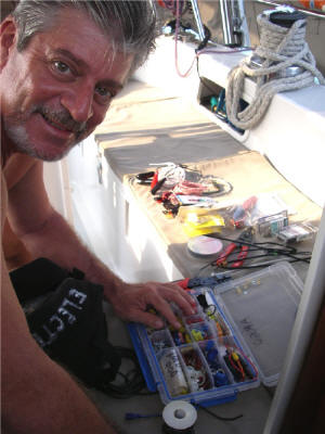
Today's boat project:
Electrical
|
As mentioned before,
things are relatively expensive here, so we mostly buy fresh produce, not
that we really need anything else. Fuel is between US$4 - $5. As
we have plenty of fuel on board, and as we want to the raise the waterline
before crossing the Rio Dulce bar, we will not buy any fuel until we're
ready to leave the Rio Dulce next season. We've enjoyed a great
authentic Italian dinner out and some local cuisine, done laundry, internet,
more CPE, website update. The boat project du jour has centered around
the water maker, first making an unbecoming noise and then completely
shutting down production. The various project fixes were first a
pressure valve adjustment (mechanical), then a fried relay (electrical) (got
fixed by scraping the burnt stuff off and reinstalling, but did buy a spare
from the Moorings), air leak with the 50 micron filter (plumbing), and as of
today it's running much smoother with crossed fingers - and we don't mention
it by name. It's funny how we don't panic over these type things like
we did the first time out. (Again, I keep forgetting to take "boat
project" pictures!) Lesson learned: always try the easiest
things first.
|
Lesson learned: Always try the EASIEST things FIRST. Our first year out. One day the
fresh water stopped flowing. Our nifty Wema gauge showed plenty
of water in the tank. The fresh water pump was making a bunch of
noise, so the pump had died. Although a mild pain-in-the-ass to
get to, Steve changed out the water pump. Still no water.
Hmmm. Bad new pump? Maybe it's electrical (a new area for us newbies) and some
component got fried. Steve calls Bob (s/v Sunrise) and Tim (s/v
Merlin) over to ARGO and they consult at length over a few beers.
When they finally stopped talking and started looking - lo and behold -
there was no water in the water tank. Duhhh. The gauge's
floater had gotten hung up inside the tank. There was no problem
and the pump had been unnecessarily replaced. |
We've had another
potential boat problem rear it's ugly head. Long story short, we
experienced various grinding noises with our engine on our way back to
Houston last year. Although we could not duplicate the noise
(surprise, surprise) Valiant factory assessed the probable culprit as a
improperly installed Spurs line cutter (done in Trinidad) and a bad cutlass
bearing, which were both remedied. Leaving Houston last month, we
again hear the noise a few different times, and by process elimination
decide it's not our [new] transmission nor the engine, leaving us with the
shaft or prop areas. Soliciting input from the net, we got lots of it.
At this time, we think the cause has been the PSS Shaft Seal, which for
unknown reasons goes dry and then makes the awful noise. By burping
the shaft seal each time before we start the motor, we have not heard the
noise since. Valiant has sent us specs to adjust it which may remedy the problem for good. It's always
unsettling having a perceived problem with the engine et al.
As I finish editing
this update, Steve, who went to town to buy a roasted chicken and a few
fresh vegies, has just arrived back laden with 6 crates brimming with food
and liquor. Preparing to admonish him for spending money on stuff we really
don't need in a place where things are more expensive, he quickly explains
that he ran into a Moorings boat just
returning from charter and they've given him all their extra stuff on board. We
used to do that when we chartered - overprovision on booze and food, then
give it away to cruisers. What goes around comes around.
Lots of liquor, mixers, case each of beer, tonic water and soda, lots of
limes, onions, 8 packages of cheese (unopened), and lots of canned goods,
pasta, condiments, etc. Another boost for the budget! Whew, maybe we should start making a practice
out of hanging around charter bases!
|
|
After provisioning in
Placencia, Belize, we plan a leisurely couple of weeks to get down to the
Rio Dulce, cay-hopping south inside the barrier reef. Our first stop
is the National Park Laughing Bird Cay, a very small and narrow island named for laughing gulls
that used to breed there. The caretaker has sectioned off part of the
island now and says the gulls are beginning to return to nest. He also is
very proud that he now has 4 lemon sharks (6'4" and the others 2 - 3 ft.)
and a nurse shark living in the waters. (We did not share his
enthusiasm.) The island
is nicely landscaped with palm trees, conch shell bordered paths, cayucos
(dugout canoes), picnic tables and thatched pavilion. It's a day trip
destination for visitors from the mainland.
|
 |
 |
|
Laughing Bird Cay,
Belize |
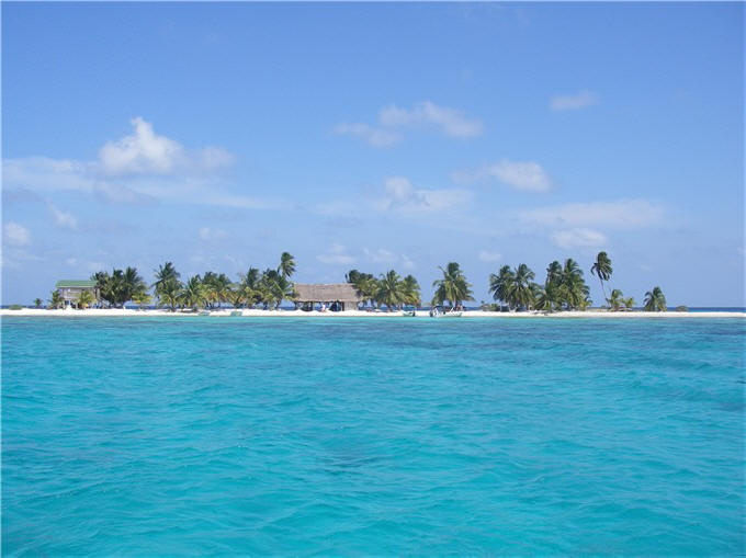
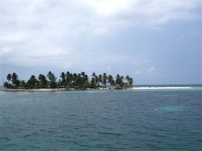
 ARGO at Ranguana
Our next stop was even more inviting:
Ranguana Cay, a smaller island less than 100 yards long and 30 paces
wide, situated right on the barrier reef itself. It's covered in very
tall palm trees, has 3 separate cabanas built up on stilts with private baths, and a little
restaurant/bar, hammocks, thatched pavilion, picnic tables, long sand bar to show
off the turquoise water and reefs great for snorkeling. We met a
couple from New York City who literally had the whole island to themselves
at night - a true escape from their hectic working world. One
afternoon while relaxing on the cay, we hear somebody yelling, and look
out to see some guy literally hanging from our bow pulpit (he must have
skedaddled up the anchor chain!). Later he explains he saw a 9
ft. shark while snorkeling nearby. We could have spent more time
hanging out there, but after 3 days moved on. As we're weighing anchor
a very large dolphin swims past us . . .
The Belizean cays for
the most part are very low lying. Hurricane Iris in
2001
was a direct hit on southern Belize and did considerable damage to Belize. It is a wonder
that some of these cays haven't disappeared completely, kind of like the old
Red Fish island in Galveston Bay.
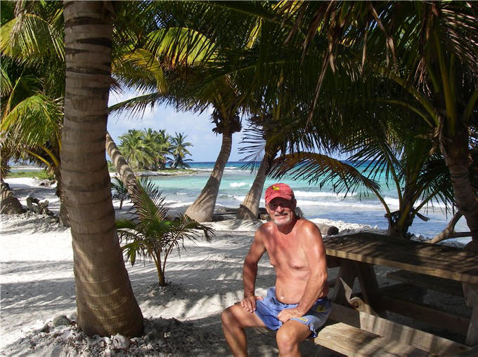
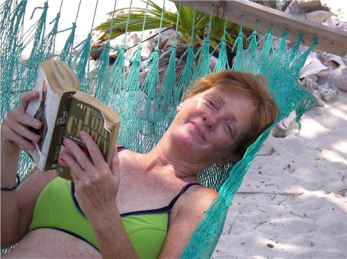
Now, as pointed out before, cruising
isn't just about sitting around drinking cold cervezas, reading and
stretching the
|
 |
|
Happy as a clam .
. . |
toes on a pristine white sand beach. There are
boat projects - the cruiser who says he doesn't have any boat projects is
lying. In PART 1 of our cruising travels our website was deficient in
showing the "other" side of cruising so we have vowed to try to be a little
more realistic this time. So, by the time we had made it to the
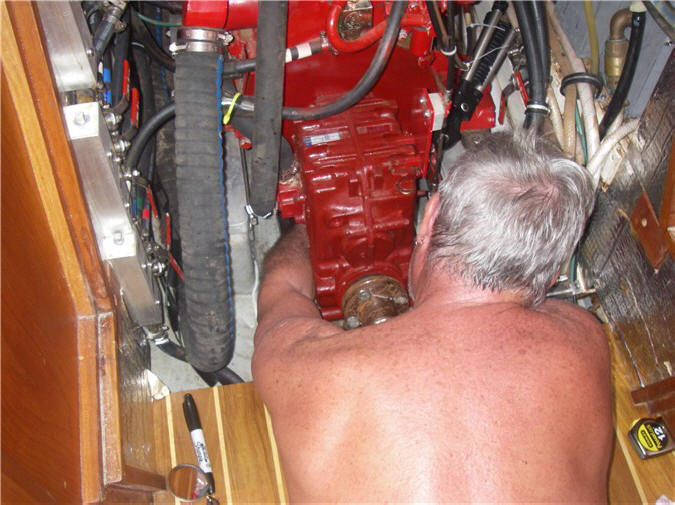
southern boundaries of Belize, Steve had worked on the water maker several
times (at right), ultimately bypassing one of the filters that was a habitual
leaker (a
water leak lets air into the system which then compromises it's integrity
and negatively affects water production).
 As
mentioned above, Steve had to
adjust the PSS Shaft Seal to try to eliminate loud, unidentifiable grinding
noises. It required additional adjustments (at left) but now think the
problem is finally resolved. Notice in both pictures that stripping
down tends to be the dress of choice when doing boat projects, and black
underwear mandatory for oil changes (not shown). Other boat projects
entailed a repair job on the electric head unit (head works but the track
for automatic operation broke); galley faucet leak (simple disassembly and
reassembly solved that). Other projects included completing our tax
return and 40 hours of CPA CPE for Deborah.
As
mentioned above, Steve had to
adjust the PSS Shaft Seal to try to eliminate loud, unidentifiable grinding
noises. It required additional adjustments (at left) but now think the
problem is finally resolved. Notice in both pictures that stripping
down tends to be the dress of choice when doing boat projects, and black
underwear mandatory for oil changes (not shown). Other boat projects
entailed a repair job on the electric head unit (head works but the track
for automatic operation broke); galley faucet leak (simple disassembly and
reassembly solved that). Other projects included completing our tax
return and 40 hours of CPA CPE for Deborah.
|
CRUISING GUIDES
for the Caribbean Central America area are scarce. The cruiser's
bible is Freya Rauscher's Cruising Guide to Belize and Mexico's
Caribbean Coast Including Guatemala's Rio Dulce.
Unfortunately, the last edition was in 1996 so many things are out of
date and she does not include waypoints, something that would be of
enormous benefit, especially in the shallow reef strewn Belize.
However, cruisers create their own and share. Some of her sketch
charts are off in latitude/longitude as they're based on the original
charts from the 1800's or whenever. Another cruising guide (we
made a mediocre copy), although it was published in 1991, is Nigel
Calder's The Cruising Guide to the Northwest Caribbean (Yucatan
to Honduras). We hear Steve Pavlidis (who has done other
cruising guides in the Caribbean) is currently working on a new guide
for this area. As far as TRAVEL GUIDES
for inland exploration, there are numerous but we are using the Lonely
Planet books which seem to be quite popular here. |
We
headed on to another island on the reef, Hunting Cay, a British
outpost, and although owned by Belize encourages day visitors from nearby
Guatemala and Honduras with no special paperwork. The next day we checked out
the huge bay anchorage at
New
Haven on the mainland (would
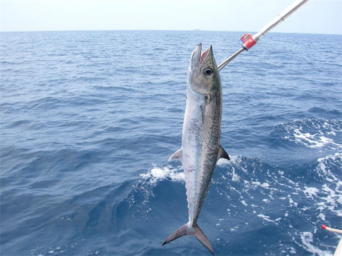
provide good protection in a big blow). Tried our luck at fishing but
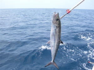
only caught a barracuda that we let go. Another day, attempted to
anchor at Frenchman's Cay but didn't like the looks of the holding (rocks
visible on narrow shelf then deep drop-off) so headed on to Cabo Tres Puntas, Guatemala.
We had cleared out of Belize 2 weeks earlier and had been told if stopped
and questioned by Belizean authorities to simply say that we had "paused"
along the way - not "stopped" - and they wouldn't have any problems.
We've learned to pretty much tell them what they want to hear and it's
easier on everybody and they don't care.
Our first stop in Guatemala is at Cabo
Tres Puntas. The area is heavily covered with coconut palm trees and
other lush vegetation. There are nice houses and small resorts
dotting the coast. We wait here several days for our window to cross
into the Rio Dulce . . .
Go to Next page for
Guatemala.
|
|
|
[ Back ] [ Home ] [ Up ] [ Next ] [ Top of page ]
|