|
[ Back ] [ Home ] [ Up ] [ Next ]
|
Click
any picture to enlarge; then close out of that window to return here. |
|
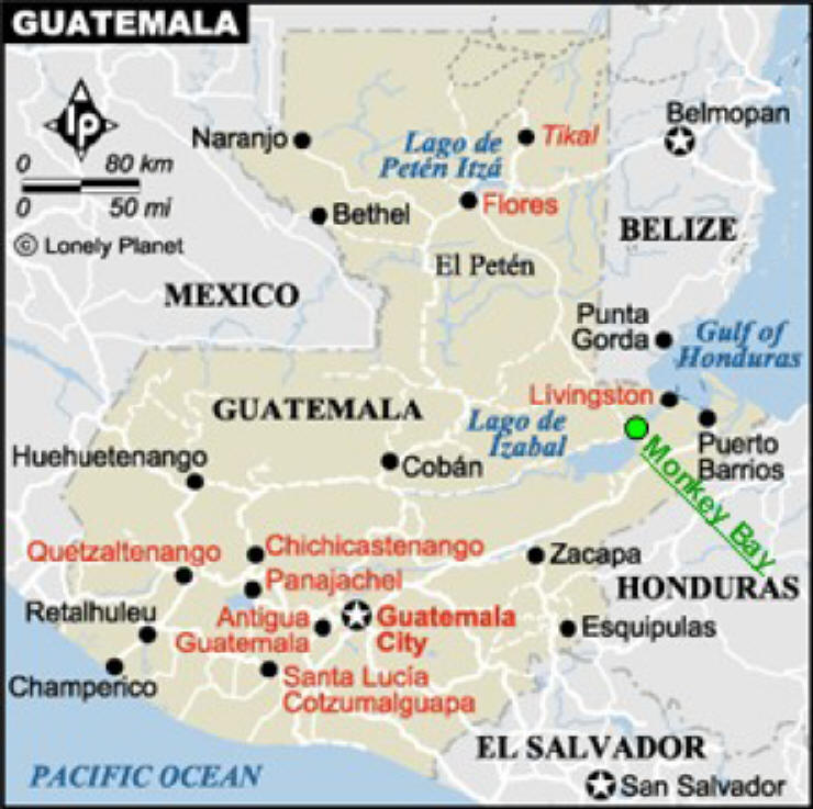
GUATEMALA
Part 1:
Overview, Rio Dulce river area, Monkey Bay Marina
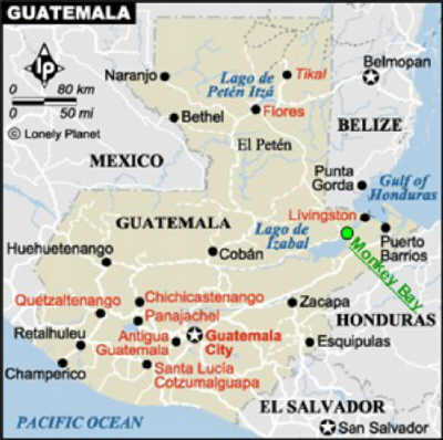
(click map to enlarge and see location of Monkey Bay
Marina) |
|
|
|
|
GUATEMALA |
|
AREA: |
Smaller than Louisiana; bit bigger
then England |
|
POPULATION: |
11.2 million (50-60% are
indigenous, mostly Maya originating from 22 "pueblos"; the rest mostly
ladinos from Spanish
settlers) |
|
LANGUAGE: |
Spanish, Mayan - 22 separate (often
mutually unintelligible) languages |
|
ADULT LITERACY: |
69% (US 99%) |
|
ECONOMICS: |
More than half live in poverty:
57% of population lives on less than
US$2.25 a day; 22% live on $1 or less; "official" minimum wage is US$125/month
(from recent statistics) |
|
MONEY: |
Quetzals US$1 = Q7.5 |
|
INDUSTRIES: |
Cement, tourism; export coffee, sugar,
bananas, textiles/clothing |
|
LARGEST CITIES: |
Guatemala City (capital),
Quetzaltenango |
|
BRIEF HISTORY and OVERVIEW
of GUATEMALA:
Guatemala has been in turmoil for centuries - politically and
environmentally - struggling for equality and tranquility. Today, Guatemala
faces many of the similar problems of other countries, just on a more
massive scale: poverty, illiteracy, human rights issues (it rates 120
out of 173 countries on the UN human development index), crime, drugs and trafficking . . .
Guatemala gained independence from Spain
in 1847, and since has been pretty much beset with ongoing political
corruption, oppression of the indigenous Maya people and lack of civil
rights for women. Peace Accords were signed in 1996 ending 36 years of
fierce civil wars between military governments, right-wing vigilante groups
and leftist rebels. Unfortunately, these guerilla wars are still what first comes to the minds of
Americans when they think of Guatemala today. During this period, it is estimated 200,000 people, mostly indigenous Maya, were killed, a million left homeless
and thousands "disappeared". Although the Peace Accords gave
hope of improving human rights of the indigenous Maya and of women, and
improving education and health care, little has been accomplished due to
continued political corruption.
Case in point. General Rios Montt,
who was Guatemala's dictator in 1982-83 during the worst period of civil war
atrocities, was advisor to admitted murderer Alfonso Portillo in becoming
the new president in 1999, the first peacetime elections in nearly 40 years.
(In his platform, Portillo cited his murders as proof of his ability to
defend his people - huh?) Montt went on to become the leader of
Congress in that election. Incredibly in 2003, Montt was granted
permission by the courts to run in the presidential election, despite the
fact that the constitution bans presidents who had in the past taken power
by coup, as Montt had. Fortunately, he was clearly defeated.
Incidentally, just last week (July 8, 2006) the local newspapers ran the
front page story that a judge from Spain has issued international orders for the arrest
of Montt (and others) on charges of "genocide, torture, terrorism and
illegal detention".
As mentioned under
Belize's Brief History
section, today Guatemala still does not fully recognize neighboring Belize as an
independent country and thus maps and travel guides of Guatemala frequently
fail to show or mention Belize.
 Geographically
and culturally, there are several diverse regions: In the west are
mountainous forested highlands populated by the 22 different peoples (with
22 different languages) of Maya origin living a
meager existence; the Pacific coast are more mestizo with large sugar cane,
cattle and cotton estates; the small Caribbean coast that is populated by
the Garifuna Indian (Carib-Africans) with a Caribbean culture and dependent
on the sea to survive; and to the north the Peten jungle plains bordering
Mexico. Geographically
and culturally, there are several diverse regions: In the west are
mountainous forested highlands populated by the 22 different peoples (with
22 different languages) of Maya origin living a
meager existence; the Pacific coast are more mestizo with large sugar cane,
cattle and cotton estates; the small Caribbean coast that is populated by
the Garifuna Indian (Carib-Africans) with a Caribbean culture and dependent
on the sea to survive; and to the north the Peten jungle plains bordering
Mexico.
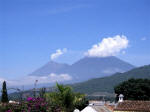
As three tectonic plates converge in
Guatemala, it is the site of earthquakes and volcanic eruptions. Major
earthquakes have occurred in 1773 (displacing the capital), 1917 and 1976.
The western highlands has 30 volcanoes, several which are active today.
Rainy season (June through November) brings rains most days (or nights),
sometimes torrential downpours, which can over-saturate the land resulting
in massive landslides. A large landslide occurred in 2005 totally
burying many mountain villages.
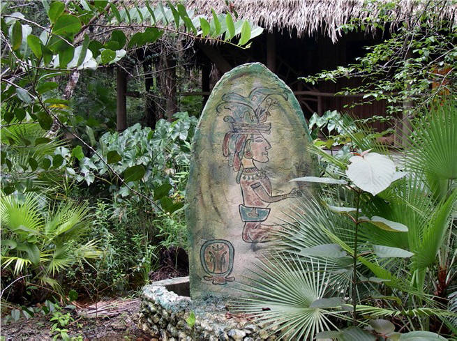
Guatemala offers many
interesting places to visit. One of the highlights is the renowned
Tikal Maya ruins in the Peten jungle in the north part of the country, near
Flores. This unique site is deep in the jungle,
and as such the wildlife (howler monkeys, parrots, toucans, tree frogs . .
.) is abundant, and the ruins have been cleared and partially restored.
One can easily obtain an after-hours pass which enables you to watch sunset
and sunrise atop the pyramids, and enjoy the more active wildlife. We
have not been there yet. In the other direction, just on the other
side of the Guatemala-Honduras border lie the Copan ruins, and although not
large in comparison, they offer amazingly well-preserved carvings not found
at Tikal.
 Another highlight, in the southern mountains
and surrounded
by active volcanoes, is the very picturesque Antigua, formerly the capital
of Guatemala until an earthquake in 1773 destroyed it. This
brightly painted town retains its historic charm with interesting ruins and
cobblestone roads throughout, and caters to the international traveler from
a 5-star hotel (beautifully built around monastery ruins) to backpackers
dormitories, a great range of restaurants and bars, and neat shopping for
any budget. Antigua is internationally known for its
Spanish immersion schools where you can live with a local family. In the same region is
scenic Lake Atitlan, also
surrounded by volcanoes and 12 villages named after the 12 apostles, and the
popular town of Chichicastenango with its huge outdoor market twice a week.
This area is where you shop for bargains on the meticulously made, hand-woven
Mayan textiles, brightly colored and elaborately designed, for
which Guatemala is known. (Each Maya village has their own
design, so it's easy to identify a person's origin.) There are several other places also of
interest to us to see in Guatemala. So far, our side trips have been
to Guatemala City, and Antigua for 3 weeks. We plan to visit the above
places and more. Another highlight, in the southern mountains
and surrounded
by active volcanoes, is the very picturesque Antigua, formerly the capital
of Guatemala until an earthquake in 1773 destroyed it. This
brightly painted town retains its historic charm with interesting ruins and
cobblestone roads throughout, and caters to the international traveler from
a 5-star hotel (beautifully built around monastery ruins) to backpackers
dormitories, a great range of restaurants and bars, and neat shopping for
any budget. Antigua is internationally known for its
Spanish immersion schools where you can live with a local family. In the same region is
scenic Lake Atitlan, also
surrounded by volcanoes and 12 villages named after the 12 apostles, and the
popular town of Chichicastenango with its huge outdoor market twice a week.
This area is where you shop for bargains on the meticulously made, hand-woven
Mayan textiles, brightly colored and elaborately designed, for
which Guatemala is known. (Each Maya village has their own
design, so it's easy to identify a person's origin.) There are several other places also of
interest to us to see in Guatemala. So far, our side trips have been
to Guatemala City, and Antigua for 3 weeks. We plan to visit the above
places and more.
 Despite
all the hardships and poverty suffered by the Guatemalan people for so long,
we are finding everyone to be very friendly, polite, helpful and unhurried.
They are happy people and make the most of what they have. We find the
adults and children alike to be very curious of us gringos, wanting to know
more about us. Most probably have never been outside of their village
or town. Family is very important, and typically the extended family
lives together in one house or a cluster of houses, which is passed down to
the next generations. The majority of Guatemalans live in a one-room
house of stone/wood poles/mud, concrete blocks or brick with roofs of
thatch, tile or tin. Floors are dirt and they have a fireplace but no
chimney (yep, the smoke goes indoors and does cause health problems). Despite
all the hardships and poverty suffered by the Guatemalan people for so long,
we are finding everyone to be very friendly, polite, helpful and unhurried.
They are happy people and make the most of what they have. We find the
adults and children alike to be very curious of us gringos, wanting to know
more about us. Most probably have never been outside of their village
or town. Family is very important, and typically the extended family
lives together in one house or a cluster of houses, which is passed down to
the next generations. The majority of Guatemalans live in a one-room
house of stone/wood poles/mud, concrete blocks or brick with roofs of
thatch, tile or tin. Floors are dirt and they have a fireplace but no
chimney (yep, the smoke goes indoors and does cause health problems).
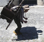 The
people are very hardworking (you seldom see people just sitting around like
you do in many Caribbean islands and Venezuela), and unfortunately, they
still do
everything the hard way - e.g., you seldom see dollies or
wheelbarrows. Men and women routinely carry enormous loads on their
backs, frequently a head strap around the forehead supports a sling used to
carry a huge bag. Women carry young children or other loads using a
very long and wide "sash", tzut, wrapped around the shoulder and waist, and women
and young girls carry heavy loads on their heads. It is not uncommon
to see a woman with a large load on her head, a small child slung from her
back and another load in front. The
people are very hardworking (you seldom see people just sitting around like
you do in many Caribbean islands and Venezuela), and unfortunately, they
still do
everything the hard way - e.g., you seldom see dollies or
wheelbarrows. Men and women routinely carry enormous loads on their
backs, frequently a head strap around the forehead supports a sling used to
carry a huge bag. Women carry young children or other loads using a
very long and wide "sash", tzut, wrapped around the shoulder and waist, and women
and young girls carry heavy loads on their heads. It is not uncommon
to see a woman with a large load on her head, a small child slung from her
back and another load in front.
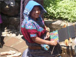 The Guatemalan women
take much pride in their appearance and surprisingly a large number of women
and girls wear their native dress of the hand-woven textiles - you see them
pretty much everywhere except in cosmopolitan Guatemala City. More on that
later. The Guatemalan women
take much pride in their appearance and surprisingly a large number of women
and girls wear their native dress of the hand-woven textiles - you see them
pretty much everywhere except in cosmopolitan Guatemala City. More on that
later.
|
|
|
RIO DULCE
Tarzan territory

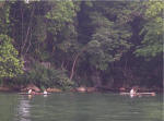
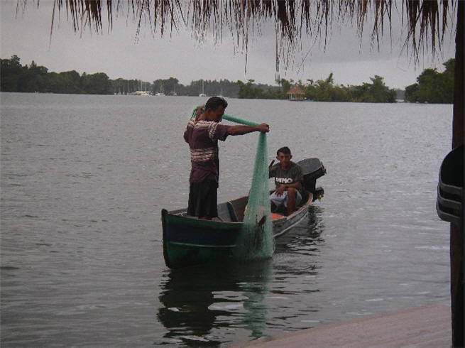
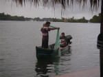
Cayucas
Family of 6 in cayuca - the woman is the only one
paddling - very typical
Typical village
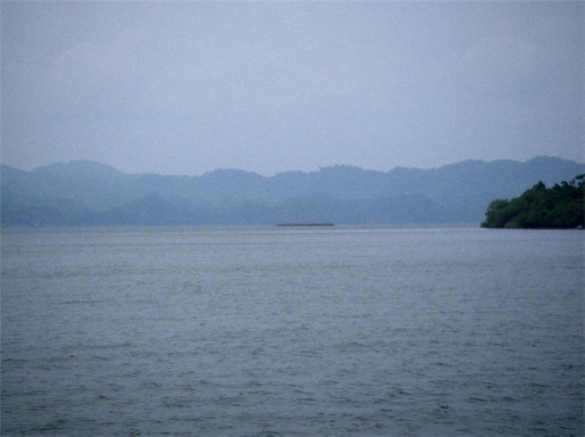
Golfete
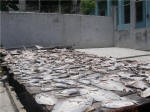
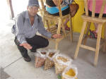
One of many pallets of fish sun drying
|
RIO DULCE, MAY 9, 2006 --
: ARGO will spend hurricane (rainy) season (June 1 - November 30) in probably
the best hurricane hole in the Caribbean: the Rio Dulce river in Guatemala.
The Rio Dulce is a 25-mile long river starting at large Lake Izabal fed by
runoff from the mountains to the west, winding
through the jungles and surrounded by high mountains, and emptying along
Guatemala's scanty 36-mile Caribbean coastline. The only hitch is
crossing the shallow mud bars at the mouth of the river at Livingston:
At mean low water the bar depth is only 5'5". We draw 6'4" (i.e.,
we need 6'4" of water under the boat before touching). This necessitates crossing the
bar at highest tide, which occurs during full or new moons. The
highest the tide ever gets is 7'5"
and tide tables predicted we would see 7'2". On May 13 we leave
our anchorage at Cabo Tres Puntas in the dark, transit the Bay of Honduras
and arrive at the lone buoy marking the beginning of the shallow bars - this is the only navigation aid - on a rising tide, about half an hour
before it will peak at 7:44
a.m. Using waypoints from other cruisers and landmarks, we "blindly"
motor in at moderate speed, surprisingly seeing 5'9" a couple of times and
less than 6' for half a mile, but we never slow. Whew, we passed our
bar exam!
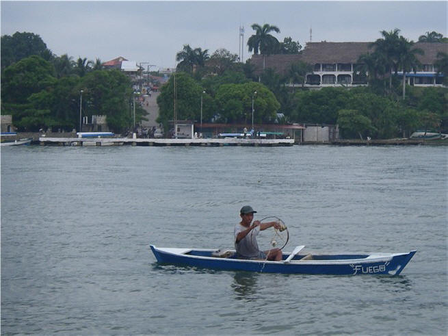
We anchor at Livingston for the night
and, as we have heard from others, experience a truly efficient clearing in
process: Customs and immigrations visited our boat promptly upon
arrival, providing us with a numbered map and instructions on where to go, how much
to pay and locations of ATMs - a total of 5 stops. Livingston is
unique to Guatemala in that it is populated primarily by the Garifuna
Indians, a mixture of Carib Indian and African, known for their distinctive music and
more African appearance. Due to increasing winds and wild currents
that kept swinging ARGO around on her anchor, we did not feel comfortable
leaving her that evening for dinner and local music.
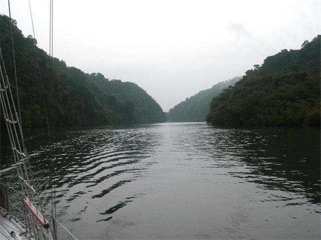
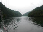
Early the next morning, we set out for a
solitude cruise up the Rio Dulce river, navigating the winding river through
300 ft. limestone canyons
dense with palm trees and jungle foliage. This is where the Tarzan movies with Johnny
Weismueller were filmed. The familiar ocean sounds we are accustomed
to hearing are replaced by the eerie, but alluring, high pitched jungle noises of
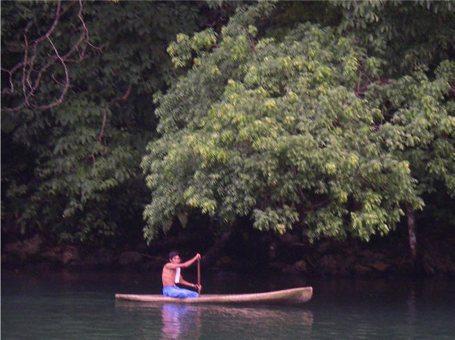
birds, monkeys and who knows what else. We see many cayucas,
small dugout canoes powered by an oar, with the locals fishing or families traveling
quietly.
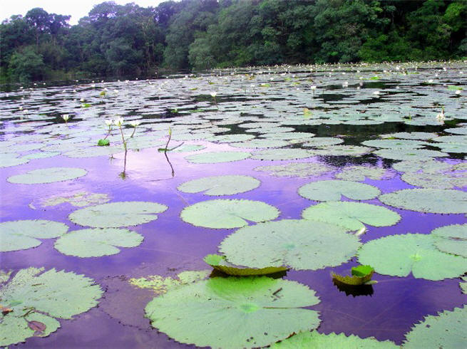
A very peaceful trip up the river which opens up into the Golfete, a large but
shallow gulf where we anchor for the night at Gringo Bay, home of Jennifer,
friend-of-the-cruisers. As a transplanted Minnesotan, she is well known
on the river and sells fresh robalo (snook) fillets and smoked (which rivals
any smoked salmon we've ever had), fresh basil, coconut oil and she makes
courtesy flags among other things.
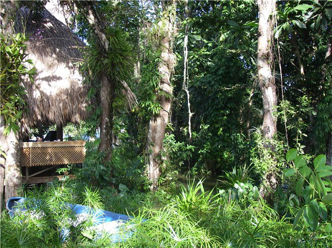
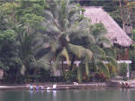
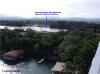
20 miles up the river is our new home
for the season at
Monkey Bay Marina
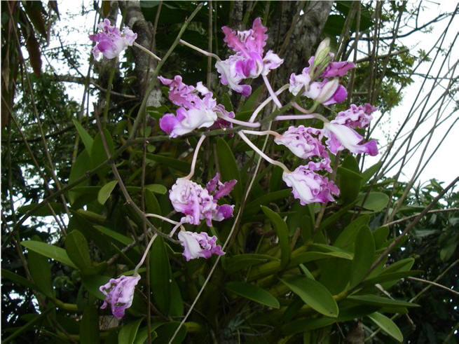
(see below). It is situated in the beautiful orchid- and
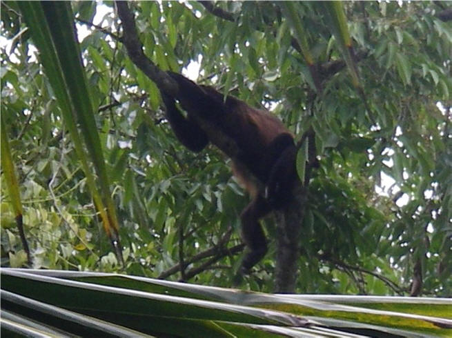
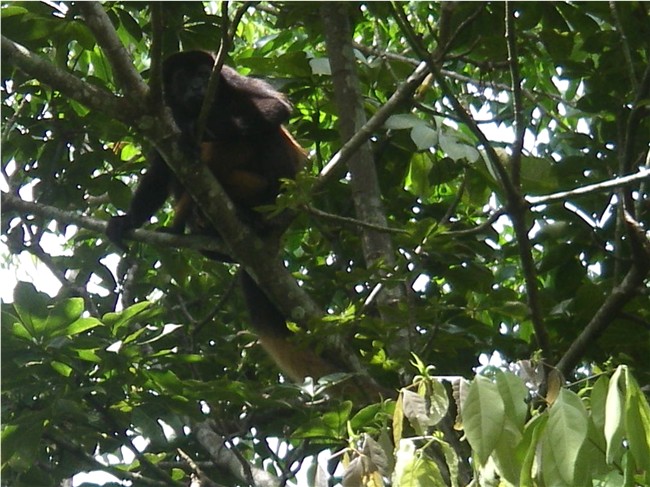
bromeliad-rich jungle, with howler monkeys plentiful. It is very
peaceful and pleasant and we have thoroughly enjoyed our stay here.
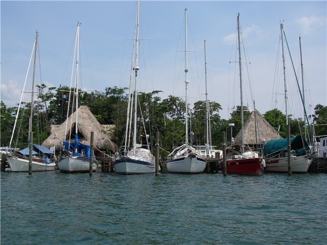
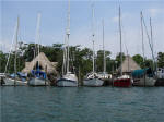
Of the 22 boats here at Monkey Bay now, 8 boats
are liveaboards with 6 of them from Texas (Port Aransas and Houston).
The other boats are in "storage" while their owners are away.
Incidentally, the boat next to us had a friend visiting from California when
we arrived at Monkey Bay. Turns out that we went to Gordon West's
Radio (HAM) School in Alemeda
with this friend in 2001, and during that weekend Gordon called
our Monkey Bay neighbor as a demonstration during class - what a small
world, once again!
|
ARGO 3rd from left
To small ranchito, docks
|
Hear and see Howler Monkey
VIDEO |
|
 |
|
Howler monkey snoozing after breakfast |
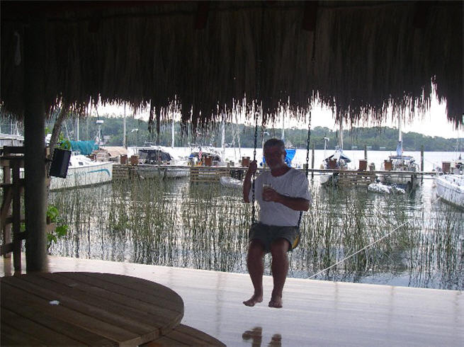
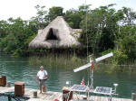
From big ranchito, ARGO + dinghy to left of Steve


Monkey mommy with baby
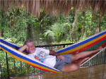
Big ranchito with lots of hammocks,
swings, tables, kitchen. During June's "flood" river was only a few
inches from its beautiful tongue'n groove wood floor
 |
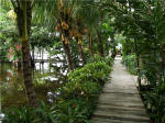
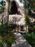
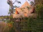
MONKEY BAY MARINA is a
small, quiet 22-boat marina, accessible only by water (good for security,
along with the 2 dogs), is probably the nicest and most secure marina
available on the river. It has new, sturdily built docks, pilings (so
you don't have to med moor) and finger piers with side boards (so your boat
doesn't get caught under the pier when the river level drops). Another
big plus is that it has a very large, reliable generator so that when the
local power goes out, as it frequently does especially during rainy season,
the generator kicks on. It's located on a river bend, so it enjoys
strong breezes in the afternoon (more so than any other marina) that keeps
things very comfortable. These features make it very desirable.
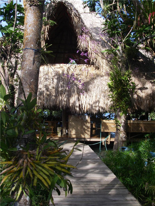
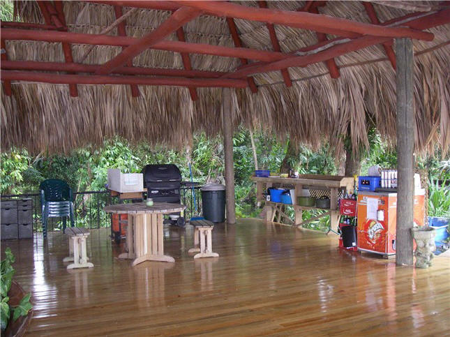
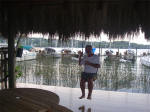
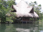
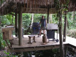
It has 2 ranchitos (thatched roof,
open-air palapas built over the water) with swings, hammocks and tables.
A brand new 3rd ranchito now contains the kitchenette facilities with
propane grill and cooktop.
Other amenities include bathroom/ shower,
washer/ dryer, full-size community refrigerator/ freezer/ ice maker,
wireless internet, DVD
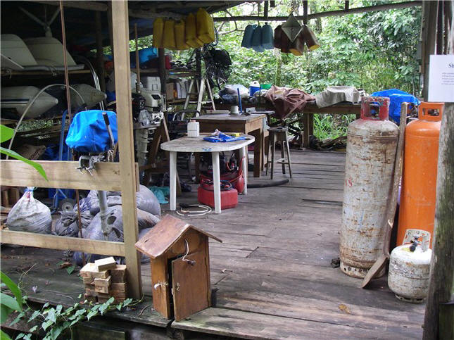
player, board games, books and a large workshop with storage out back. And of course the honor
bar is always stocked with cold beer and other drinks. Monkey Bay has
a lancha (large hard dinghy) that we use for group dinners out or for
"field trips".
We pay (in 2006) US$170/month + electricity.
Water -- filtered, chlorinated and UV'd -- is free. We do run our A/C,
otherwise the rain will eventually create a mold/mildew problem inside.
We thoroughly waterproofed all our outdoor canvas before we left so it
should be fine.
There is no restaurant or bar so it
keeps the place quiet with little traffic, which we like. Other
marinas have restaurants, bars, pools, social events, swap meets, etc. that we can
use.
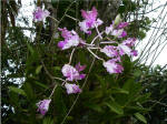
The marina is visually very appealing,
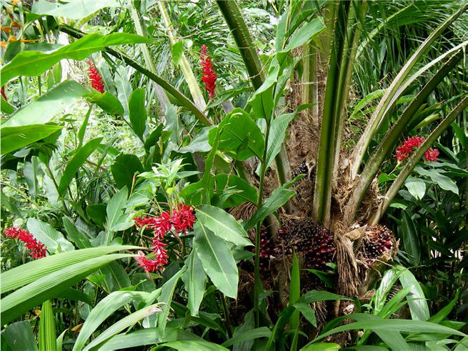
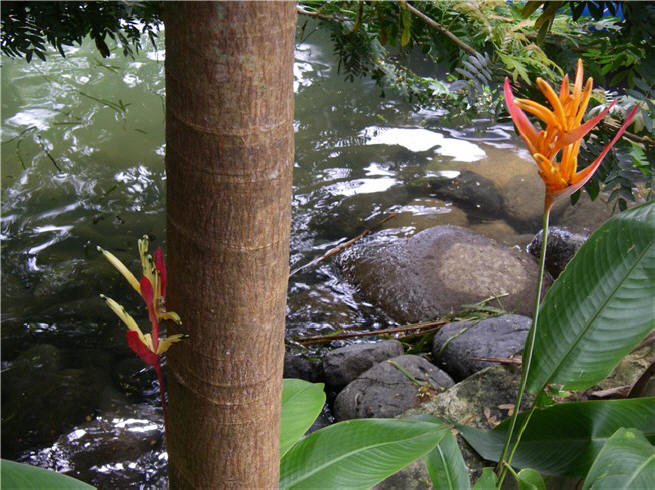
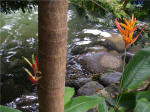
nestled in the jungle. There are huge orchids and bromeliads all over
the place, and nicely landscaped by the owner's wife with colorful foliage,
ginger, bird of paradise, heliotropes and numerous other flowering plants.
The howler monkeys frequently hang out in the trees, at times startling us
with their very loud growling sounds. We've seen one boa constrictor curled
up in a tree.
A curiosity here, and entertainment as
well, is the sudden appearance of thousands of large army ants. In
follow-the-leader fashion, they invade an area looking for roaches, spiders
and scorpions, and disappear just as quickly as they came. The other
day, a line of army ants extended from one ranchito, down 2 walkways and
into the big ranchito, heading off in several directions including the roof
support beams, and literally within 15 minutes they had reversed direction
and disappeared, taking a spider with them. Really amazing to watch.
The marina is owned by a Guatemalan-born German
and is currently managed by a couple who cruised here from Texas. The owner,
who lives with his family in Guatemala City,
originally bought the property as a weekend house so that his kids and their
friends would have a place to play, swim and boat at leisure without any
worries. There's
even a zip line from one ranchito to the other across the water!
See
www.monkeybaymarina.com for their website.
 |
Big ranchito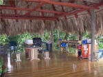
New kitchen ranchito (11/06)
Big ranchito at sunset

Workshop out back - a good place to
monkey-watch |
|
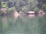
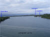
The Rio
Dulce area has more than a dozen marinas ranging in size from a few boats
to 75 boats, all within about 3 miles of each other. Each marina is
unique in it's atmosphere and cruiser appeal, although most are quite
picturesque with landscaped grounds amid the wild jungle growth, thatched ranchitos and
walkways over the water. The river here is about 1/2 mile wide and
at times strange "whirlpools" form due to the river outflow and tidal
changes. The water is not clear, but green/muddy from the mountain
runoff. The mornings are
still, but the winds pick up steadily in the afternoon. This makes
Monkey Bay very comfortable in the afternoon, but can also cause the
river to develop some choppiness.
 As distances traveled on the river can
be a few miles by water and the afternoon winds/currents can make it
choppy/whirly, we bought a 13 ft. lancha, a hard fiberglass dinghy of sorts,
from another cruiser and are using that, with our 15 hp outboard, to travel
the river now. It makes it faster and easier for commuting or
exploring, although our regular inflatable would have worked OK here.
We should have no problem selling the lancha to another cruiser when we leave.
Our dinghy is currently stored on ARGO's foredeck. As distances traveled on the river can
be a few miles by water and the afternoon winds/currents can make it
choppy/whirly, we bought a 13 ft. lancha, a hard fiberglass dinghy of sorts,
from another cruiser and are using that, with our 15 hp outboard, to travel
the river now. It makes it faster and easier for commuting or
exploring, although our regular inflatable would have worked OK here.
We should have no problem selling the lancha to another cruiser when we leave.
Our dinghy is currently stored on ARGO's foredeck.
|
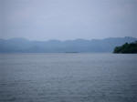
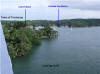
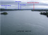
PANORAMIC VIEW of the RIO DULCE and LOCATION of
MONKEY BAY and OTHER MARINAS |
  |
|
* *
* Click above to enlarge panoramic view and see labels *
* *
These pictures
were taken from the top of Guatemala's highest bridge - and the
longest (1 kilometer) in Central America - they are quite
proud of it. It is a local tourist attraction and buses, vans
and other travelers frequently stop and get out at the top for a
look.
The bridge is
quite long and a group from Monkey Bay briskly walk the bridge most
mornings. Two round trips is 2.5 miles, making for
a good workout. At the top we usually run into two
enterprising men with Polaroid cameras who take pictures of the
tourists - amusingly, many photos are done with the people posed in
front of their truck or car, not in front of the scenery!. They, and the other locals, think that us gringos
are "muy loco" - they cannot understand why we walk for exercise.
Commuter vans slow down thinking that surely we would want a ride.
Alternatively, we have found a nice walk just out of town that takes
us out into the country/jungle on paved roads but with little
traffic.
|
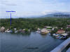
The closest town
is Fronteras, although the locals call it Rio Dulce. (If you ride
the long-distance bus and say you want to go to "Fronteras", you will be
dropped off at the Guatemala/Honduras border as that is the "frontier";
 this happened to a cruiser.) Fronteras is about a mile from Monkey
Bay on the other side of the river. It's pretty typical with
everything located along the one main street, including numerous outdoor
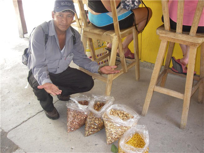
produce markets and street food vendors. As it is
the main thoroughfare for this part of the country, there's a lot of
traffic including 18 wheelers and trucks hauling cattle. We buy our produce at the outdoor markets
(always wash everything in chlorinated water back on the boat) and there
are several mini-marts and one large grocery store for groceries and
specialty deli items. Casa Guatemala (benefits Guatemalan orphans),
which has a store and also comes by lancha to the marina twice a week,
always has very good meats, large selection of cheeses, great yogurt,
yummy sour cream (a cross between American sour cream and cream cheese), so getting good, fresh food is not a problem. this happened to a cruiser.) Fronteras is about a mile from Monkey
Bay on the other side of the river. It's pretty typical with
everything located along the one main street, including numerous outdoor
produce markets and street food vendors. As it is
the main thoroughfare for this part of the country, there's a lot of
traffic including 18 wheelers and trucks hauling cattle. We buy our produce at the outdoor markets
(always wash everything in chlorinated water back on the boat) and there
are several mini-marts and one large grocery store for groceries and
specialty deli items. Casa Guatemala (benefits Guatemalan orphans),
which has a store and also comes by lancha to the marina twice a week,
always has very good meats, large selection of cheeses, great yogurt,
yummy sour cream (a cross between American sour cream and cream cheese), so getting good, fresh food is not a problem.
As mentioned above, it is rainy season, and as such we were
expecting rain 24x7. But that isn't the case. It's kind of like
Florida where you get afternoon rain every day. Around June 1st, we
started getting afternoon rain and/or rain during the night. Yes, it
can be torrential, but typically it's off and on so you can make a dash
across the river before the next shower. We have actually enjoyed it
as the rain and clouds keep the temperatures pleasant.
However, a couple of weeks ago the
nighttime rains were unrelenting to the point that the river rose over 3
feet within a week, putting the dock only 2 inches above water. The river
came very close to record heights reached 11 years ago when hurricane Mitch
came through the region. We never lost electricity and everything
stayed above water. But Monkey Bay was the only marina so fortunate.
All the other marinas were under water and most, if not all, lost electricity.
As of this writing, the water is subsiding an inch or two a day, but it
still has a long way to go. Some marinas are still without power
(electrical boxes under water) and most docks/buildings are starting to dry
out. Within 2 hours one night, our lancha (hard dinghy) had filled to
the point it might go under, so bailing is sometimes necessary during the
night. Steve's in the process of procuring parts to build a bilge pump
with a floater switch that plugs into the cockpit 12-volt plug, thus
allowing for unattended automatic bailing.
As we end this section I can report that
the river has almost fallen to the level it was at the end of June - 2
months ago. The largest marina on the river was without electricity to
the docks for a full month, but we never lost it here at Monkey Bay.
Last Saturday we participated in a Poker Run (more of a crawl than a race) -
 by dinghy you go to 8
marinas, buy a drink and look around, pick up a poker card (sealed in envelope) at each and
then return to the starting point to see who can make the best poker hand
out of their 8 cards. Of course the hand is all luck, but the real
purpose is to get people to visit other marinas and meet new cruisers.
It is the end of August now and although there are roughly 400 boats here on
the Rio, there are not that many cruisers as most take this opportunity
(hurricane season) to visit family and friends. Things should start
jumping in a month or two as people return to their boats and start
preparing to leave after the hurricane season. The only "big" boat
project we've had was our hot water heater sprung a leak. We still had
hot water while we waited for another to show up from the U.S. (had to have
the exact same one as the space for it is "exact"), and a few weeks later it
got installed. by dinghy you go to 8
marinas, buy a drink and look around, pick up a poker card (sealed in envelope) at each and
then return to the starting point to see who can make the best poker hand
out of their 8 cards. Of course the hand is all luck, but the real
purpose is to get people to visit other marinas and meet new cruisers.
It is the end of August now and although there are roughly 400 boats here on
the Rio, there are not that many cruisers as most take this opportunity
(hurricane season) to visit family and friends. Things should start
jumping in a month or two as people return to their boats and start
preparing to leave after the hurricane season. The only "big" boat
project we've had was our hot water heater sprung a leak. We still had
hot water while we waited for another to show up from the U.S. (had to have
the exact same one as the space for it is "exact"), and a few weeks later it
got installed.
|
Does anybody really know what time
it is? Well,
actually NO. Mexico is the only country in Central
America that observes Daylight Savings Time (DST) due to some NAFTA
agreement or something, so we change our clocks while in Isla Mujeres,
Mexico in April accordingly, just like in the States. Then just prior
to leaving Belize for our trip across the bar in Guatemala, there are
numerous discussions on both the local and regional radio nets as to
whether Guatemala is now observing DST or not - about half of Guatemala
is reportedly trying out DST. This leads to the question of which
time the tide tables (for crossing the bar) use - an hour off could mean
getting stuck on the bar! Between the tide tables on the internet,
The Cap'n, Nobeltec and other applications, DST and Standard Time (ST)
are both used (even though, I think, historically Guatemala has always
been on ST). A week later, we hear that now Honduras has decided
to give DST a go, too. Also affected are the various SSB and Ham
nets that broadcast based on UTC/GMT/Zulu time, so you have to mentally
adjust your time to compensate for this difference.
Now that we're in
Guatemala, everybody is observing DST, so we assume Belize is the only
country in this region still on ST. |
|
|
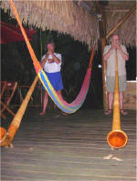
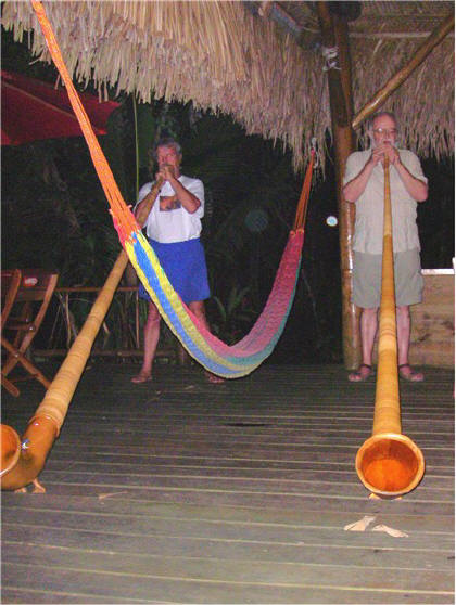
Two cruisers playing their alpenhorns
at Casa Perico after dinner. They carry them on their boats (they come
apart in segments). They actually made good music and were
entertaining.
Guatemala continued .
. . |
[ Back ] [ Home ] [ Up ] [ Next ]
[ Top of page ]
|