|
[ Back ] [ Home ] [ Up ] [ Next ]
|
Hold mouse over pictures
for captions.
Click any picture to
enlarge; then close out of that window to return here.
|
|
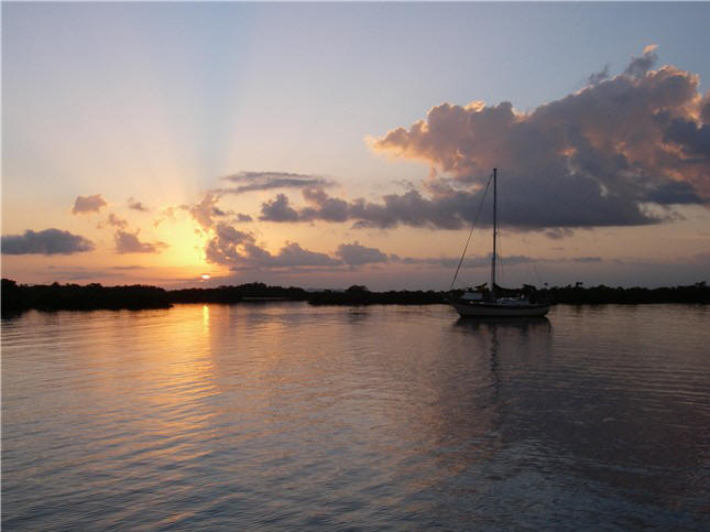
BELIZE
'07
We spent a little time in
southern Belize in 2006 en route from Houston to the Rio Dulce. This year we
wanted to explore the northern part of Belize. The northern part of
Belize is, in general, very shallow with reefs and coral heads. It is
doable, but with our 6'4" draft we have to be particularly careful and don't
like to tempt fate, so we are a bit conservative compared to some of the
other cruisers.
 Making our way north inside the reef (this reef is the 2nd largest barrier
reef in the world next to Australia's Great Barrier Reef), we anchored in:
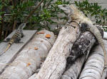
Wild Cane Cays (left), the only boat the first night in this pleasant area surrounded by numerous
low-lying mangrove cays; Placencia, a big cruiser hangout, where we
saw the Super Bowl on the big screen; Colson Cays; Drowned Cays, large
cays with numerous "hurricane" cuts through the land - we really liked this
secluded (only boat) and protected anchorage. Negotiating the wide
channel of Ship's Bogue at high tide we saw 5 1/2 feet but never slowed,
just goes to show you that holding your breath really does help. A
couple of miles across 7-9 ft. flats we were at St. George's Cay with it's
nice resort ashore, but shallows up far out so we had to anchor about a mile
from shore before dinghying in for a look. Making our way north inside the reef (this reef is the 2nd largest barrier
reef in the world next to Australia's Great Barrier Reef), we anchored in:
Wild Cane Cays (left), the only boat the first night in this pleasant area surrounded by numerous
low-lying mangrove cays; Placencia, a big cruiser hangout, where we
saw the Super Bowl on the big screen; Colson Cays; Drowned Cays, large
cays with numerous "hurricane" cuts through the land - we really liked this
secluded (only boat) and protected anchorage. Negotiating the wide
channel of Ship's Bogue at high tide we saw 5 1/2 feet but never slowed,
just goes to show you that holding your breath really does help. A
couple of miles across 7-9 ft. flats we were at St. George's Cay with it's
nice resort ashore, but shallows up far out so we had to anchor about a mile
from shore before dinghying in for a look.
Next day through the
aptly named Porto-Stuck, we did, backed up and tried again. About now
you're wondering about navigation aids. Well, in this case there are
palm fronds lined up on one side to use as a guide, and apparently we got
too close to them when we hit 5 ft. (at high tide). Later we were told
that the locals move/replace them periodically and they don't always get
them back in the same spot. Oh. Additionally, in good light
(which we had until a barge went through and the clouds moved in)
you can actually see the keel marks left by other boats and pick your way
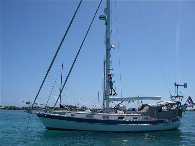
through. Steve was perched up on our rat line (ladder in the rigging;
demonstrated at right),
with camera ready, but he couldn't see squat. Incidentally, the
areas we have been so far are pretty much clear of coral heads with only sand or
grassy bottoms, so if you do touch, it's not a big deal, unless you get
stuck! and apparently we got
too close to them when we hit 5 ft. (at high tide). Later we were told
that the locals move/replace them periodically and they don't always get
them back in the same spot. Oh. Additionally, in good light
(which we had until a barge went through and the clouds moved in)
you can actually see the keel marks left by other boats and pick your way
through. Steve was perched up on our rat line (ladder in the rigging;
demonstrated at right),
with camera ready, but he couldn't see squat. Incidentally, the
areas we have been so far are pretty much clear of coral heads with only sand or
grassy bottoms, so if you do touch, it's not a big deal, unless you get
stuck! After
Porto-Stuck, 3 miles of 6-8 feet depths, then another 3 miles of depths
gradually increasing to 9 feet (whew! never thought I'd feel so much relief
at seeing 9 feet!) and we arrive at Caye Caulker, our home for the next
month or so.
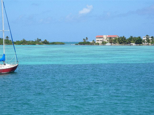
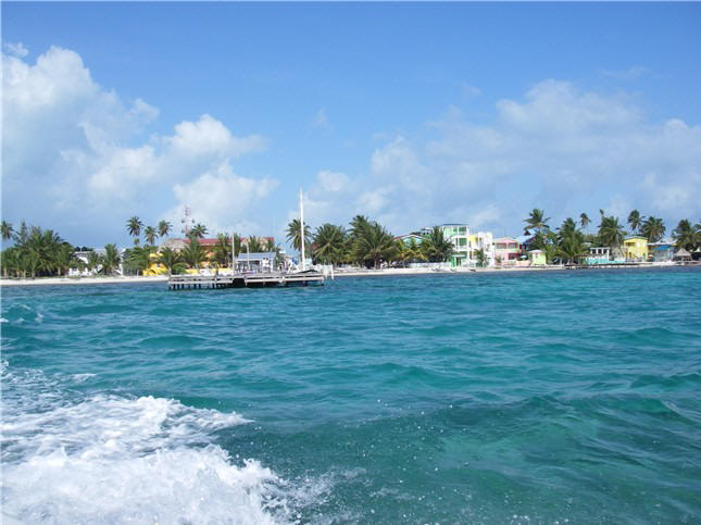
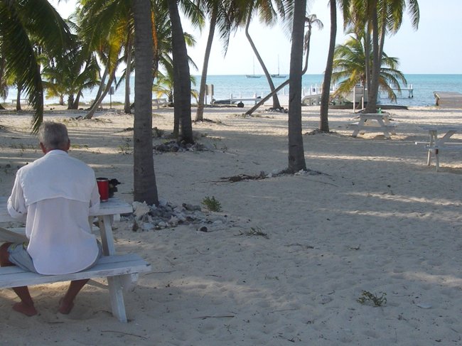
 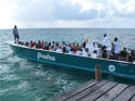 Caye
Caulker (left) is a quaintly small (4 x .3 mile), all sand (no pavement) island, with only pedestrian, bicycle
and golf cart traffic. This is a tourist destination for backpackers
and water enthusiasts and those just wanting to laze around. Regular
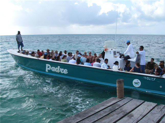
water taxi service (right) connects Caye Caulker with Belize City (45 minutes) and
Ambergris Caye (30 minutes) to the north. Caye
Caulker (left) is a quaintly small (4 x .3 mile), all sand (no pavement) island, with only pedestrian, bicycle
and golf cart traffic. This is a tourist destination for backpackers
and water enthusiasts and those just wanting to laze around. Regular
water taxi service (right) connects Caye Caulker with Belize City (45 minutes) and
Ambergris Caye (30 minutes) to the north.
  Ambergris Caye (town of San
Pedro), well-known as a diving destination and more touristy, is similar to Caye Caulker, but a bigger (25 miles
long), busier version with lots of resorts and "second homes" stretched up and
down the beach. Ambergris in some ways reminds us of Grand Cayman
Island. Ambergris Caye (town of San
Pedro), well-known as a diving destination and more touristy, is similar to Caye Caulker, but a bigger (25 miles
long), busier version with lots of resorts and "second homes" stretched up and
down the beach. Ambergris in some ways reminds us of Grand Cayman
Island.
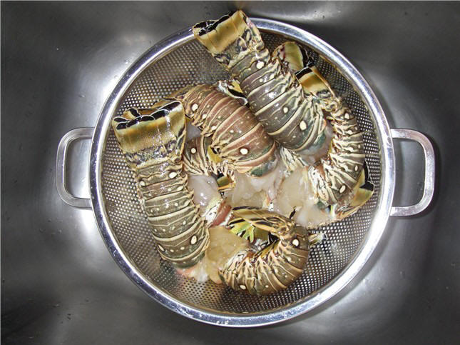
 Prior
to lobster season ending February 15, in the late afternoons Steve would
dinghy to the cleaning "stations" and buy lobster tails as the fishermen
de-headed them. The large tails are sold to the Caye Caulker fish coop
(which is not allowed to sell retail) who sends them to Belize City for
sorting and shipping to Red Lobster in the USA; the smaller tails we bought.
Altogether, we bought 26 succulent tails at about US$1 each - 3 tails per
person makes for a great dinner. We dined on them for Valentine's Day,
had a delicious dinner onboard when guests visited (below), and the rest are
in our freezer for future treats. Prior
to lobster season ending February 15, in the late afternoons Steve would
dinghy to the cleaning "stations" and buy lobster tails as the fishermen
de-headed them. The large tails are sold to the Caye Caulker fish coop
(which is not allowed to sell retail) who sends them to Belize City for
sorting and shipping to Red Lobster in the USA; the smaller tails we bought.
Altogether, we bought 26 succulent tails at about US$1 each - 3 tails per
person makes for a great dinner. We dined on them for Valentine's Day,
had a delicious dinner onboard when guests visited (below), and the rest are
in our freezer for future treats.
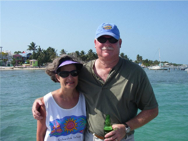
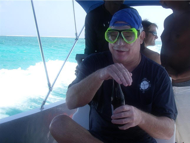
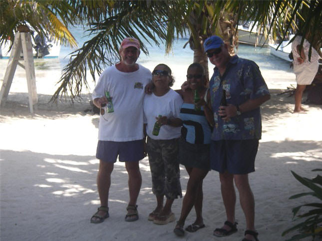
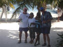
 Houston
friends Susan and Red (live-aboards on s/v Compromise) recently visited us here at Caye Caulker for a
wonderful, laid
back vacation. They volunteered to shop and bring stuff to us,
and so we let them - 2 duffle bags and one box full of stuff,
including our mail, boat spares, hard to find items, DVDs, etc. While
here, we dinghyed to the barrier reef and snorkeled on
our own. In an effort to maximize their time, another day we took a
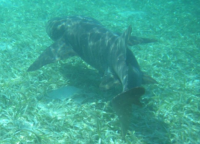
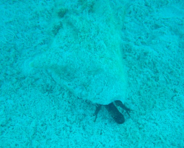
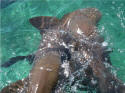
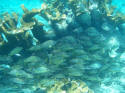
snorkel tour up to Hol Chan Marine Reserve (Ambergris): At Shark Ray
Alley we swam with sharks (nurse) up to 10-12 feet long and lots of rays gliding
around us; Hol Chan Cut, a natural 30 ft. deep channel through the
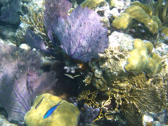
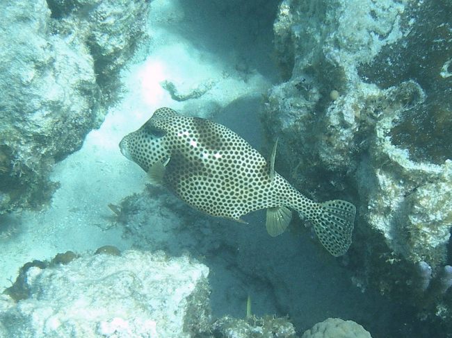
reef, gave us a chance to snorkel the walls on either side, seeing lots of
colorful fish and healthy coral. Our guide, with long pointer in hand,
gave us great Houston
friends Susan and Red (live-aboards on s/v Compromise) recently visited us here at Caye Caulker for a
wonderful, laid
back vacation. They volunteered to shop and bring stuff to us,
and so we let them - 2 duffle bags and one box full of stuff,
including our mail, boat spares, hard to find items, DVDs, etc. While
here, we dinghyed to the barrier reef and snorkeled on
our own. In an effort to maximize their time, another day we took a
snorkel tour up to Hol Chan Marine Reserve (Ambergris): At Shark Ray
Alley we swam with sharks (nurse) up to 10-12 feet long and lots of rays gliding
around us; Hol Chan Cut, a natural 30 ft. deep channel through the
reef, gave us a chance to snorkel the walls on either side, seeing lots of
colorful fish and healthy coral. Our guide, with long pointer in hand,
gave us great
| |
|
|
|
|
 |
 |
 |
 |
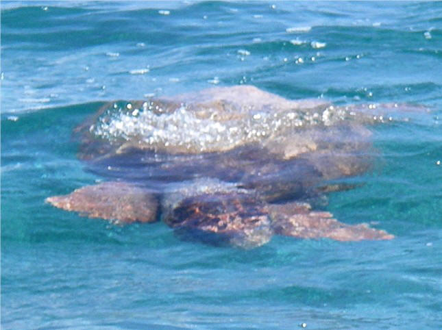
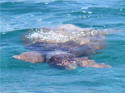
| Giant
(3 ft.) leatherback turtle |
Baby
nurse sharks frolicking |
Fish
under coral camouflage |
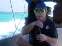
Red, in protective garb getting
drenched underway, but saving the Belikin beer |
 |
 |
 |
 |
 |
|
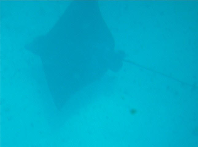
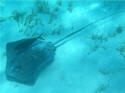
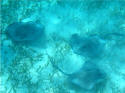
Stingray with stowaway |
Stingrays stirring |
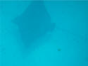
Spotted eagle ray |
Boys
misbehavin' . . . |
.
. . boys behavin' |
| |
|
|
|
|
narrative on what we
were seeing below. Towards the end of the day, our boat broke down
(brand new engine),
then the rescue boat ran out of fuel, not to worry, swapped fuel tanks and
made it back just before dusk. Another day we hopped on the open-air
water taxi to Ambergris where we rented a golf cart and pretty much explored the whole island.
|
 |
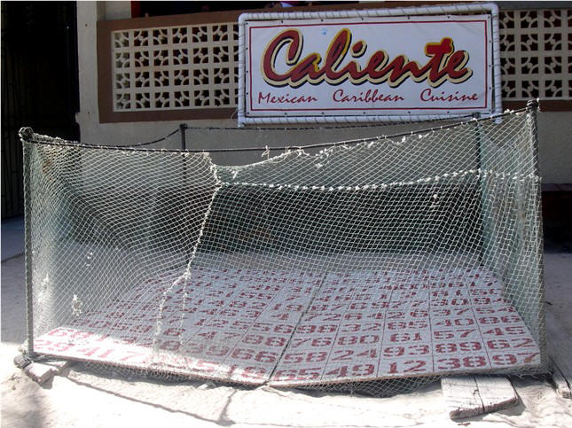
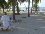
The Chicken Drop in
Ambergris Caye on Wednesday nights: Place your bet as to where the
chicken will drop its load (and we're not talking eggs). Winner
has to clean up the poop before collecting the cash prize. |
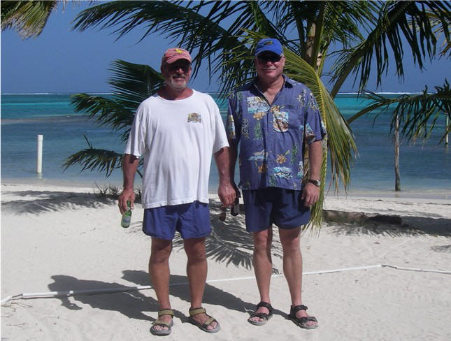
After Susan & Red
left, a 45-minute water taxi trip took us to Belize City, a dirty,
uninspiring little big city (pop. 50,000) to visit the Belize Zoo (below),
check out Cucumber Beach Marina for future reference, and check out the
shopping, finding a couple of hard-to-find grocery items.
|
|
BELIZE ZOO |
|
The Belize Zoo is
located 30 miles outside Belize City in the wild. It was started
in 1983 after the making of a documentary film (and the Harrison Ford
movie Mosquito Coast) left a couple dozen native Belizean animals
unsuitable to be released back into the wild. Since then the zoo
has grown to over 100 animals all indigenous to Belize, many endangered.
The zoo is outstanding in that humans are able to visit the animals in
their native habitat, as opposed to the animals being put into a human
environment.
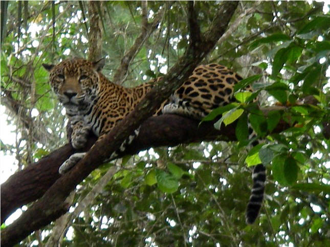
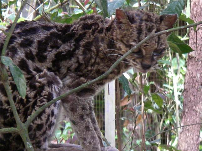
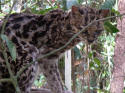
Several wild cats
are native to Belize - the jaguar, ocelot, puma, margay and peccary.
Other native animals include deer, owls, hawks and eagles, agouti,
foxes, and other animals that now looking at their names I don't know
what they are.
We had an
extremely knowledgeable guide that greatly enhanced our experience.
Steve (who's not super-big on zoos or botanical gardens) gave this zoo
visit "2 thumbs up" (and they didn't even have a beer stand).
|
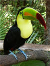 |
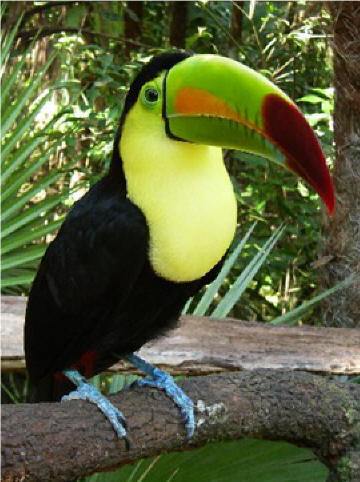
Rambo, the keel-billed toucan
(national bird) |
|
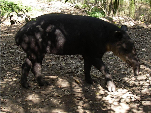
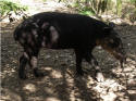
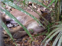
April
the Tapir (national
animal) |
 |
| |
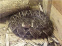 |
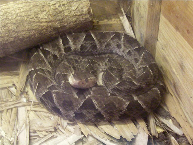
The fer-de-lance
is one of the deadliest snakes in the world. According to our
guide, if bitten, chewing and rubbing the acacia tree (right) on the
bite could save your life. The thorns on the tree are hollow and
inhabited by ants . . . so be careful
. . . |
 |
| |
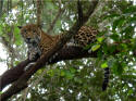 |
Cats
. . . |
 |
|
 |
| |
|
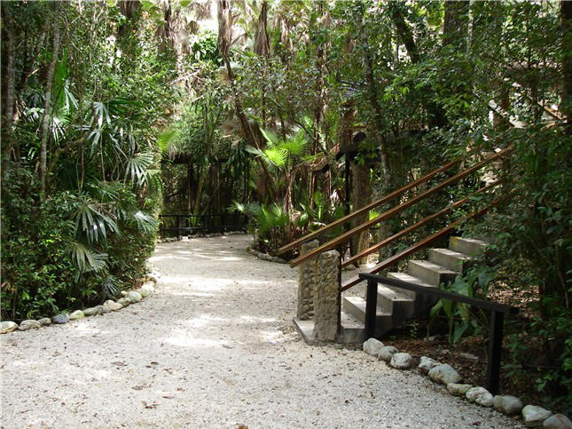
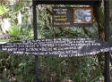
The zoo is well done in the wild
with winding walkways, viewing platforms, and unique interpretative
signage and graphics. |
 |
 |
|
| |
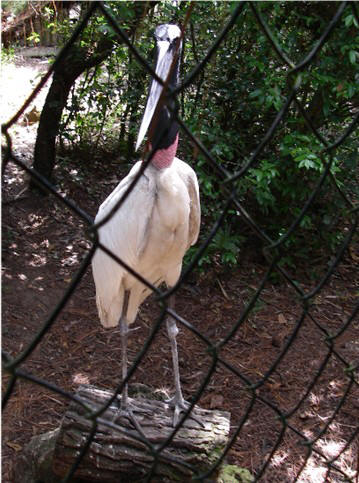
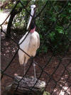
| A
tall (3+ ft.) Jabiru stork: stand back, he's very quick and accurate
with that very long, thin beak of his |
 |
|
 |
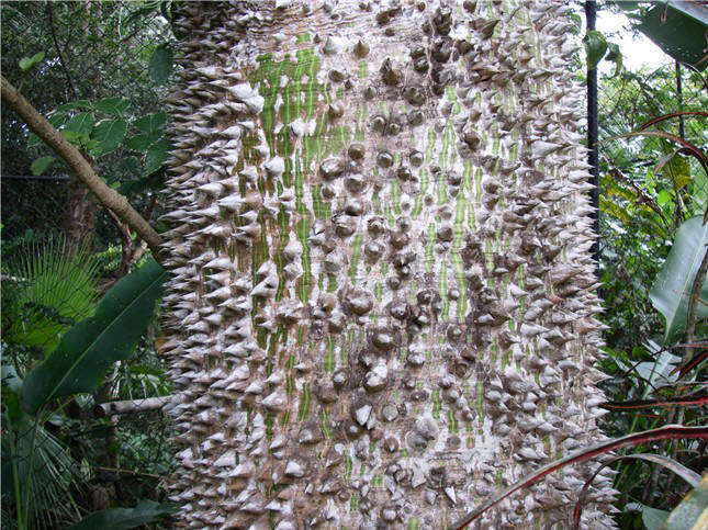
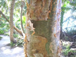
The
trunk of the Ceiba tree has big "thorns". This tree was considered
sacred by the Mayas. |
| |
 |
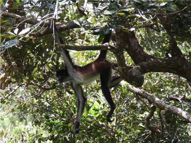
Several troupes of monkeys: spider (left) and howler |
 |
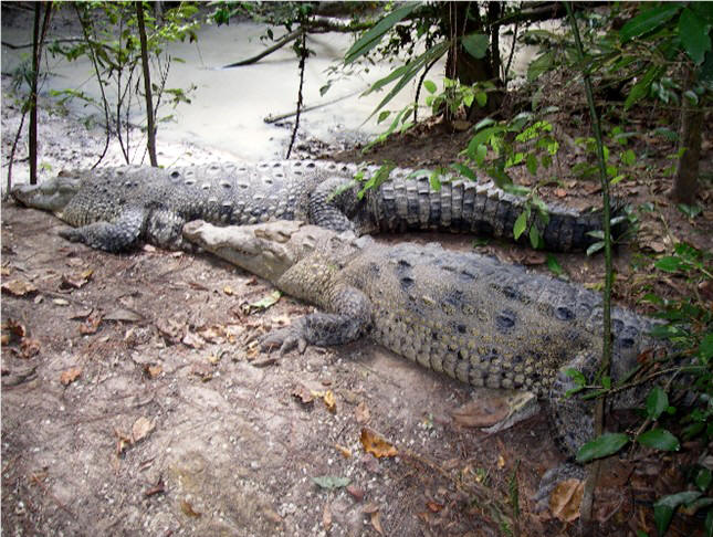
Crocodiles are around in the Cays,
even at Caye Caulker (cruisers are careful where they take their dogs to
shore!) |
| |
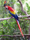
|
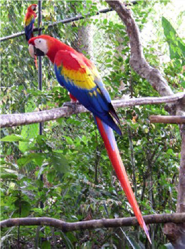
Scarlet macaws |
 |
|
 |
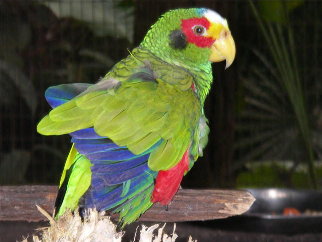
Parrot |
| |
|
|
As of this writing, we are contemplating
our options of how best to depart this area and
head to Belize's atolls: Turneffe, Lighthouse and Glovers. High-high
morning tides are next week, which not only will give us needed water depth
but also good light overhead. Be sure to check out our Position
Report(s) as there should be some cool satellite views of our anchorages! |
|
BELIZE
'07 continued
 We leave Caye Caulker on a high-high
tide late morning so as to pass over the skinny waters of Porto-Stuck and Ship's Bogue with as much water as possible under our keel (or, rather, to lessen
the amount of sand we have to plow through). Fortunately, we were able
to tag along after 3 other boats that called off depths to us so we made it
to Water Cay without too much excitement (we saw less than 6 ft. several
times but didn't slow much). Water Cay is near the barrier reef and on the
edge of the commercial ship channel, affording us a brightly lit parade of
cruise ships coming and going out of Belize City throughout the night.
A cruiser on a catamaran initiated a happy hour for all anchored so we were
able to meet a bunch of new cruisers that up to now we had only heard of on
the single side band radio (SSB) NW Caribbean Net. The next day we sail east,
breathing a huge sigh of relief to be in deep water once again. But that won't
last long. We leave Caye Caulker on a high-high
tide late morning so as to pass over the skinny waters of Porto-Stuck and Ship's Bogue with as much water as possible under our keel (or, rather, to lessen
the amount of sand we have to plow through). Fortunately, we were able
to tag along after 3 other boats that called off depths to us so we made it
to Water Cay without too much excitement (we saw less than 6 ft. several
times but didn't slow much). Water Cay is near the barrier reef and on the
edge of the commercial ship channel, affording us a brightly lit parade of
cruise ships coming and going out of Belize City throughout the night.
A cruiser on a catamaran initiated a happy hour for all anchored so we were
able to meet a bunch of new cruisers that up to now we had only heard of on
the single side band radio (SSB) NW Caribbean Net. The next day we sail east,
breathing a huge sigh of relief to be in deep water once again. But that won't
last long.
Belize's
Offshore
Atolls
Off Belize's great barrier reef lie
three South Pacific-style atolls: Turneffe Islands, Lighthouse Reef
and Glovers Reef. An atoll is a coral ring rising from great depths
and enclosing a central lagoon. These Belizean atolls rise suddenly
with little warning, accounting for numerous ship wrecks. Inside the
atolls are a few cays, or islands, and there are just a few spots where the
reef is barely deep enough to pass over safely. These atolls are known
for their fabulous diving and snorkeling, as little traffic comes this way
so fish and coral are able to thrive. As you approach each atoll in
beautiful cobalt water, it is obvious where the atoll's coral rim is as the water inside
is strikingly turquoise. (Remember, you need good light, i.e., the sun
above or behind you, to adequately see the color change.) In some
areas the reef breaks through the surface, but in most places it is only
a few feet under.
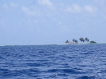
A stop at Turneffe (30 miles x 10
miles) on the outer west side gives us protection from the east winds.
We carefully dinghy around the inner lagoon, it's bank being too shallow for
a dinghy in some areas. There's a nice resort on a cay, not a single
person in sight and we hear they do not like cruisers so we didn't venture
on shore. Diving is suppose to be good here, but from the little we
saw it didn't look all that inviting.
Lighthouse
Reef,
about 25 miles offshore the
barrier reef, is the gem of Belize's cruising grounds, although it
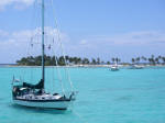 doesn't get much traffic due to its out-of-the-way location. From Turneffe we
motor sailed due east (directly into the wind and waves), tacking
numerous times to lessen the discomfort. The atoll is 25 miles in
length and 4.5 miles wide. There are five cays (Half Moon being one of
them) on Lighthouse and only
three major breaks lead into the enclosed lagoon where depths are less than
30 ft. and in most cases too shallow for ARGO. It's got it all: Clear
turquoise water, pretty beaches, a red-footed booby bird sanctuary, a great
blue hole, miles of virgin coral reef and no way to spend a buck (although
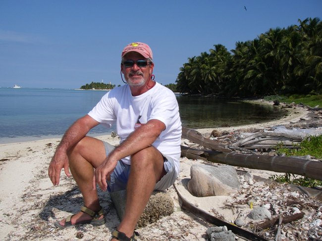
Steve did buy a beer from a local worker on the beach). Picture:
Half Moon Caye, east end, with sister ship Querencia. doesn't get much traffic due to its out-of-the-way location. From Turneffe we
motor sailed due east (directly into the wind and waves), tacking
numerous times to lessen the discomfort. The atoll is 25 miles in
length and 4.5 miles wide. There are five cays (Half Moon being one of
them) on Lighthouse and only
three major breaks lead into the enclosed lagoon where depths are less than
30 ft. and in most cases too shallow for ARGO. It's got it all: Clear
turquoise water, pretty beaches, a red-footed booby bird sanctuary, a great
blue hole, miles of virgin coral reef and no way to spend a buck (although
Steve did buy a beer from a local worker on the beach). Picture:
Half Moon Caye, east end, with sister ship Querencia.
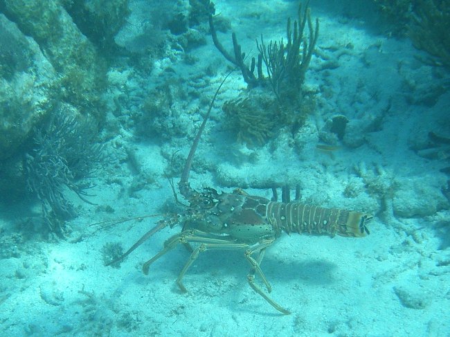
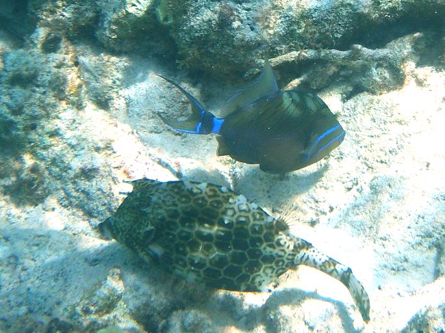
We finally met
up with s/v Querencia, a Valiant from Texas, who are avid divers and Carl an
amateur video photographer. Deborah dove with them numerous times,
refilling her tanks from moored liveaboard dive boats. Around the rim
of the atoll are moorings for dive boats and dinghies. Within feet of
these, the outside wall sharply drops down, making diving along the wall
(generally 20 ft. and deeper) easy and spectacular. Lots and lots of
fish - big and small - and beautiful, colorful corals. Sighted were lots of
big rays (spotted eagle and sting), turtles, schools of groupers including 2-3 ft. Nassau groupers, 4 ft. tarpons,
green and spotted moray eels, large schools of big trunkfish, lobster, crab
and conch. Probably the highlight was spotting a 4-5 ft. Goliath
Grouper (Jewfish) lounging disguised against the wall on a shelf. He
didn't mind Carl lighting him up and taking video, as the grouper proceeded
to up-chuck the indigestible remains of 3 fish heads and a couple of lobster
legs, all caught in living color. Another highlight for Deborah was
NOT seeing any sharks, although a few divers had reported seeing a shark or
two on other dives.

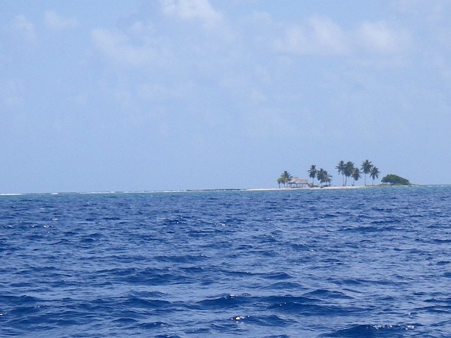
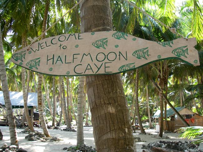
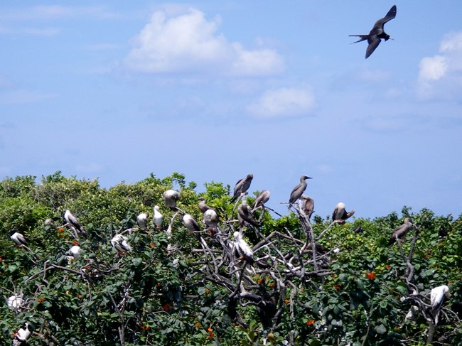
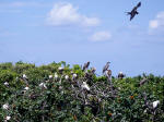
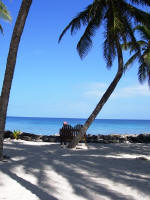
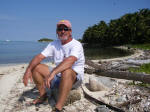  Half Moon Caye
at Lighthouse Reef, is
a Natural Monument and a World Heritage Site sponsored by the Belize
Audubon Society, and is a must see. A small cay (half a mile long) with
lush coconut palms and picnic tables at one end, a rustic camp for
adventurous travelers into diving and kayaking in the middle. At the
other end is the Booby and Frigate bird sanctuary with observation deck
smack in the middle of nesting birds amid dense orange-flowering ziricote
trees. Picture left: Half Moon Cay; Right: Happy hour ashore; ARGO with
sister ship Querencia in background. Half Moon Caye
at Lighthouse Reef, is
a Natural Monument and a World Heritage Site sponsored by the Belize
Audubon Society, and is a must see. A small cay (half a mile long) with
lush coconut palms and picnic tables at one end, a rustic camp for
adventurous travelers into diving and kayaking in the middle. At the
other end is the Booby and Frigate bird sanctuary with observation deck
smack in the middle of nesting birds amid dense orange-flowering ziricote
trees. Picture left: Half Moon Cay; Right: Happy hour ashore; ARGO with
sister ship Querencia in background.
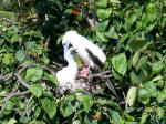 The
Red-Footed Booby, Sula sula, although fairly common in the
Pacific,
are rare in the Atlantic and Caribbean (although we did see them in Las
Aves, offshore Venezuela). They live on Half Moon Cay for 10 months,
nesting in November and laying eggs in December. Both parents incubate
one egg per nest for 7 weeks and the young remain in the nest until July (we
saw them in May). Boobies are strong flyers, soaring over the ocean
and then diving from great heights to catch fish and squid. Boobies
are named after their apparent behavior: In times past, when hungry mariners
approached their remote breeding islands the birds were curious rather than
alarmed and thus were easily caught. Picture:
Booby mom and baby in nest. The
Red-Footed Booby, Sula sula, although fairly common in the
Pacific,
are rare in the Atlantic and Caribbean (although we did see them in Las
Aves, offshore Venezuela). They live on Half Moon Cay for 10 months,
nesting in November and laying eggs in December. Both parents incubate
one egg per nest for 7 weeks and the young remain in the nest until July (we
saw them in May). Boobies are strong flyers, soaring over the ocean
and then diving from great heights to catch fish and squid. Boobies
are named after their apparent behavior: In times past, when hungry mariners
approached their remote breeding islands the birds were curious rather than
alarmed and thus were easily caught. Picture:
Booby mom and baby in nest.
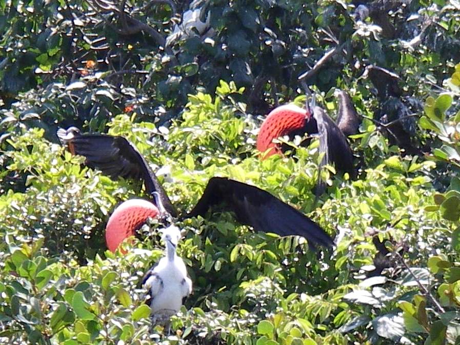
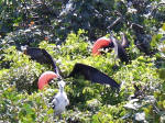  The
magnificent Frigate bird with it's 7 ft. wingspan is a superb flyer and can
be seen hovering in the air motionless. However, Frigate birds are
poor divers and cannot land on water. Consequently they often harass
the Boobies when they have returned from a day of fishing and rob the
Boobies of their food, as we witnessed. The Frigate bird will also rob
the Boobies' nests of young and/or eggs - this scene is the emblem of the
Belize Audubon Society. Picture left:
Boisterous male Frigate birds puffing up their red gullets to attract the
females; fluffy white Booby baby, foreground, crying out for food.
Right: Boobies and Frigates coexisting. The
magnificent Frigate bird with it's 7 ft. wingspan is a superb flyer and can
be seen hovering in the air motionless. However, Frigate birds are
poor divers and cannot land on water. Consequently they often harass
the Boobies when they have returned from a day of fishing and rob the
Boobies of their food, as we witnessed. The Frigate bird will also rob
the Boobies' nests of young and/or eggs - this scene is the emblem of the
Belize Audubon Society. Picture left:
Boisterous male Frigate birds puffing up their red gullets to attract the
females; fluffy white Booby baby, foreground, crying out for food.
Right: Boobies and Frigates coexisting.
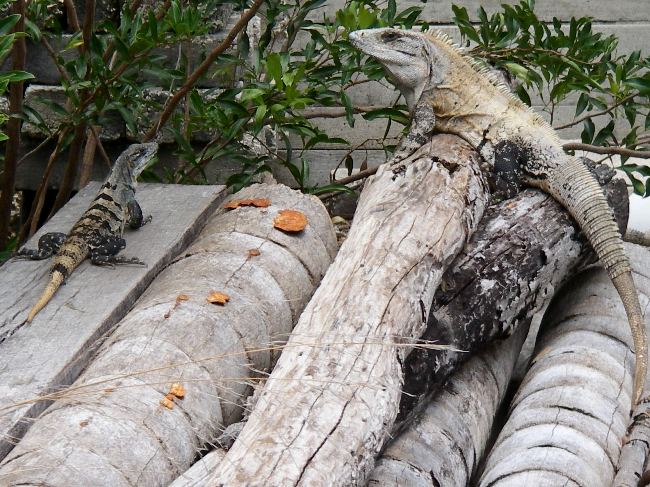
 Green Iguanas populate Half Moon Cay
which serves as an important breeding ground to this endangered species.
Being the largest lizard in Belize, a full grown male can reach a length of
7 ft, with most of this being in the tail. Delicious flesh and rich
eggs make it a delicacy in this area - it is known locally as "Bamboo
Chicken". No, we have not knowingly eaten iguana. Probably
tastes like chicken. Green Iguanas populate Half Moon Cay
which serves as an important breeding ground to this endangered species.
Being the largest lizard in Belize, a full grown male can reach a length of
7 ft, with most of this being in the tail. Delicious flesh and rich
eggs make it a delicacy in this area - it is known locally as "Bamboo
Chicken". No, we have not knowingly eaten iguana. Probably
tastes like chicken.
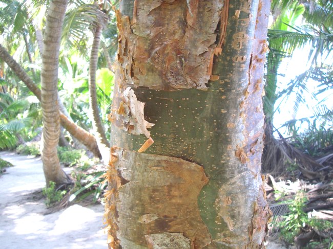
 The
Gumbo Limbo tree is nicknamed the "tourist tree" as it's eye-catching red
shaggy bark is always peeling.
The bark is a common tropical remedy for skin affections (sunburn, insect
bites, rashes) and taken internally treats colds, fevers and urinary tract
infections. The
Gumbo Limbo tree is nicknamed the "tourist tree" as it's eye-catching red
shaggy bark is always peeling.
The bark is a common tropical remedy for skin affections (sunburn, insect
bites, rashes) and taken internally treats colds, fevers and urinary tract
infections.
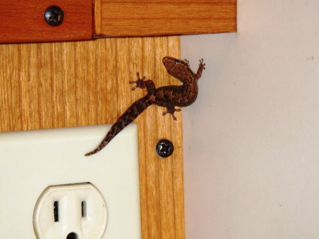
 Koko
is our diminutive liveaboard gecko. Geckos make popular "pets" for
cruisers as they eat roaches and other bugs and are rarely seen or heard.
Apparently Koko came aboard mid January, the last time we were at a dock,
although he didn't make his presence known until April. Several
sightings in one week, plus the lack of any bugs on board, lead us to
believe Koko is earning his keep and is on the hunt for more food.
Picture: Got a glimpse of him at night. Koko
is our diminutive liveaboard gecko. Geckos make popular "pets" for
cruisers as they eat roaches and other bugs and are rarely seen or heard.
Apparently Koko came aboard mid January, the last time we were at a dock,
although he didn't make his presence known until April. Several
sightings in one week, plus the lack of any bugs on board, lead us to
believe Koko is earning his keep and is on the hunt for more food.
Picture: Got a glimpse of him at night.
|
|
Lessons in survival:
Staying in touch The Northwest
Caribbean Net, a cruiser net on the single side band radio (6209 USB at 1400 zulu)
meets daily. This net covers a large area, from the Gulf of Mexico (we
picked it up leaving Galveston last year) and down to Panama when
propagation is good. Boats underway are able to file a "float plan" so
others know where you are and can make sure you arrive to your destination
safely; cruisers can check in to let others know where they are; and it's a
good time to have "traffic" and communicate with friends; weather is given;
and there is an information needed/given section so you can get guidance on
anchorages or information on fuel sources, customs and immigration, etc. It's primary function,
however, is to help insure a safe passage by making others aware of your
plans and whereabouts. In fact, two boats we know from Monkey Bay
Marina on
the Rio Dulce, within a 2-week period, were abandoned at sea and the cruisers
rescued in good health as a result of these nets.
|
S/V Paradox, a catamaran, was heading
north across the Florida Straits when a squall suddenly hit, capsizing
their boat late afternoon. They were trapped in a small air space
in one pontoon overnight. Their EPIRB had emitted only one blip,
then stopped, not credible enough for the U.S. Coast Guard (USCG) to
respond.
Fortunately, these cruisers were very disciplined in their check-ins on
the radio. They had missed their 6:00 pm check-in which caused
some concern for their cruising friends. When they missed their
check-in the next morning with their friends and also the NW Caribbean Net,
action was immediately taken notifying the US Coast Guard, the HAM net
and their families. In the mean time, they broke through their
pontoon, and were able to set off their EPIRB. They were rescued
by a USCG helicopter that evening, 24 hours after they capsized. Their catamaran remained
floating upside down somewhere in the Gulf Stream, tracked by the USCG.
Lessons learned: Know how to
operate your EPIRB in the dark. Also, your check-in schedule should
include a contingency plan in case you miss a check-in, which sometimes
happens due to rough weather, a boat issue needing immediate attention, etc.
This backup plan might include several alternate check-in times on various
frequencies. If no contact is made after the scheduled attempts, then
the action that should be taken should be made clear. These extra
steps is what many cruisers don't do, but we can all learn from their
experience.
(Above based on what we heard on the
radio. These cruisers are in the process of writing up their
experience along with what they learned to pass on to other cruisers.) |
|
S/V Sailabout, a monohull, left the
Galapagos Islands heading west to cross the South Pacific to the Marquesas.
They were 700 miles out of Galapagos when their bobstay chain parted,
causing the
bow pulpit and forestay to pull free from the fiberglass bow and deck, allowing
water to flood the boat in fairly rough seas. They put out a
mayday call (fortunately, they had just bought a SSB radio before
transiting the Panama Canal) which was picked up on one or more nets.
They also set off their EPIRB, but did not have a life raft. It
was fortunate that they didn't lose their engine - allowing them to
motor with the waves - or batteries - allowing them to maintain
radio contact. After having more than 3 feet of water inside the boat,
they got that under control (patching and motoring with the waves).
A cruising boat in the area headed their direction and kept nearby
throughout the night, it being too rough to attempt a rescue. The
next day, with their boat in gear and seacocks (the valves through the
hull) open, they came along side a freighter and were
transferred onboard underway, as they saw their boat head off, and
eventually down, into the
Pacific. The couple is Norwegian, the freighter that picked them
up just happened to be Norwegian and they are currently on board heading around Cape Horn to
Brazil where they will disembark.
(The above based on what we heard on the
radio and from emails.) |
|
|
After a wonderful, relaxing 3 weeks at
remote Lighthouse Reef, it's time for an overnight passage south to Roatan,
Honduras. As expected, southeast wind and waves make for an
uncomfortable motor sail, so we sail a bit to the west for Utila, Honduras.
Not expected, however, our autopilot decided not to work early on so we had
to hand steer all the way (it wasn't that long ago when that was the only
way to steer, how fast we forget). Uggghh. Ending up where we
didn't want to go (Utila) early morning, the winds finally die down as we
get in the lee of Roatan. We are then able to drop the sails and motor
due east towards Roatan, Honduras in calming seas with a rising sun
. . .
|
|
 |
|
continued . .
. |
[ Back ] [ Home ] [ Up ] [ Next ]
[ Top of page ]
|